Open PDF and Software Resources of Earth-sciences, Remote Sensing and Geographic Information System.
Wednesday, 31 July 2019
How to Extract River Shape file From Landsat Image
In This Tutorial Shows the Process of Extraction of River Shape file From Satellite Image (Such as Landsat) by ArcGIS Software.
Monday, 29 July 2019
Wednesday, 24 July 2019
Introduction to Hydraulics and Hydrology with Applications for Stormwater Management
Preface
This text was originally written to fill a long-standing need to treat the topics of storm water runoff and hydraulics together in one book. It is intended to be used by students of civil engineering, civil engineering technology, and surveying, as well as practitioners in industry and government. The topics presented are relevant to public works, land development, and municipal engineering and planning—in fact, to any designer (both engineer and technician) who must deal with the conveyance
of storm water in any aspect of his/her work.
Tuesday, 23 July 2019
eBook-Submarine Geomorphology
Contents
Introduction................................................. 1
Aaron Micallef, Sebastian Krastel and Alessandra Savini
Part I
Data and Methods in Submarine Geomorphology
Sidescan Sonar .............................................. 13
Ingo Klaucke
Multibeam Echosounders ...................................... 25
John E. Hughes Clarke
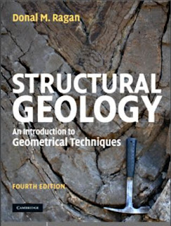
STRUCTURAL GEOLOGY An Introduction to Geometrical Techniques
Preface
The first steps in the study of geological structures are largely geometrical. This is true
in the historical development of our knowledge of such structures, in the initial stages of
any field investigation, and in the education of a structural geologist. This concern for
geometry includes the methods of describing and illustrating the form and orientation of
geological structures, and the solution of various dimensional aspects of these structures.
Monday, 22 July 2019
Digital Photogrammetry A Practical Course
Download Link Given Below the Text
Contents
Preface 1st edition.............................................................................................V
Preface 2nd edition.........................................................................................VII
Contents .......................................................................................................... IX
1 Introduction ...............................................................................................1
1.1 Basic idea and main task of photogrammetry...........................................1
1.2 Why photogrammetry ?.............................................................................3
1.3 Image sources: Analogue and digital cameras .........................................4
1.4 Digital consumer cameras ........................................................................6
1.5 Short history of photogrammetric evaluation methods .............................7
1.6 Geometric principles 1: Camera position, focal length ............................8
1.7 Geometric principles 2: Image orientation.............................................11
1.8 Geometric principles 3: Relative camera positions (stereo)...................13
1.9 Some definitions......................................................................................15
1.10 Length and angle units..........................................................................16
1.11 A typical workflow in photogrammetry.................................................16
Wednesday, 17 July 2019
Urban Geology Process-Oriented Concepts for Adaptive and Integrated Resource Management
Preface
This book reflects the experience of the authors, working in a multidisciplinary team of specialists and scientists on urban geosciences including geology, hydro-geology, hydrogeophysics, river-ecology, and on research projects at the Basel University. Besides the academic activities, the Applied and Environmental Geology (AUG) is in charge of the geological survey of the Cantons of Basel-Stadt and Basel-Landschaft.
Sunday, 14 July 2019
GROUNDWATER QUANTITY AND QUALITY MANAGEMENT
Table of Contents
Acknowledgments ......................................................................... vii
Contributors ......................................................................... viii
1. Introduction ......................................................................... 1
Stewart W. Taylor
1.1 Groundwater Management 1
1.2 Purpose, Scope, and Organization of Book 3
1.3 Future Trends 6
1.4 References 8
2. Groundwater Hydrology ......................................................... 10
George F. Pinder
Irrigation and Water Resources Engineering
CONTENTS
Preface (vii)
1. INTRODUCTION 1—37
1.1 Irrigation ....................................................................................................................... 1
1.2 Impact of Irrigation on Human Environment ............................................................ 2
1.3 Water Resources of India ............................................................................................. 4
1.4 Need of Irrigation in India ........................................................................................... 9
1.5 Development of Irrigation in India ............................................................................ 10
1.6 Major and Medium Irrigation Schemes of India ...................................................... 12
1.7 Minor Irrigation .......................................................................................................... 15
Saturday, 13 July 2019
Investigating The History of The Earth
 |
| Investigating The History of The Earth |
Introduction
Every day we walk across its surface, admiring its variety of plants, animals, and landscapes. Earth has taken billions of years to evolve into the planet we now inhabit. This volume examines this long history, from Earth’s origins in a cloud of gas and dust to its place as a planet teeming with life. It addresses questions that scientists have long debated: how, why, and when did Earth form and develop into this complex and intriguing planet?
Thursday, 11 July 2019
Introduction to Coastal Processes and Geomorphology
Preface
This book is designed primarily as a textbook for an upper-level undergraduate course in coastal processes and geomorphology and it stems from a fourth-year course that I have taught for twenty five years at the University of Guelph. Its primary objective is to provide students with a description
of processes acting to erode, transport and deposit sediments in the coastal zone, and of the factors that act in concert with these to produce the infinite variety of features that characterise marine and freshwater coasts around the world.
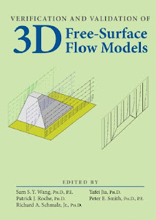
VERIFICATION AND VALIDATION OF 3D FREE-SURFACE FLOW MODELS
Contents
Chapter 1 Verification and Validation of Free Surface Flow Models ..........................1
Contributor: Sam S.Y. Wang
1.1 Introduction ........................................................................................................1
1.2 Modeling of Physical Systems ..............................................................................5
1.3 Free Surface Flow Numerical Model Development .............................................7
1.4 Verification and Validation ...................................................................................8
1.5 Outline of a Systematic Model Verification and
Validation Procedure ..................................................................................................12
1.6 Other Issues of Importance ...................................................................................14
1.7 Findings, Conclusions, Recommendations and Input Data ..................................15
1.8 Request for Feedback .............................................................................................15
1.9 References ..............................................................................................................15
Monday, 8 July 2019
Practical GIS- Use Tools Such as QGIS, PostGIS and GeoServer to Build Powerful GIS Solution.
Preface
In the past, professional spatial analysis in the business sector was equivalent to buying an
ArcGIS license, storing the data in some kind of Esri database, and publishing results with
the ArcGIS Server. These trends seem to be changing in the favor of open source software.
Sunday, 7 July 2019
Handbook of Engineering Hydrology -Environmental Hydrology and Water Management
Contents
Preface......................................................................................................................................... vii
Editor ........................................................................................................................................... xi
Contributors.............................................................................................................................xiii
1 Anthropocenic Aquifer: New Thinking..................................................................... 1
Anthony Richard Turton and Frederik Stefanus Botha
AERIAL PHOTOGRAPHY AND IMAGE INTERPRETATION
CONTENTS
Preface xi 1
Introduction 1
PART 1 GEOMETRY AND PHOTO MEASUREMENTS 25
2 Geometry of a Vertical Aerial Photograph 27
3 Principles of Stereoscopic Vision 44
4 Scale of a Vertical Aerial Photograph 68
5 Horizontal Measurements—Distance, Bearings, and Areas 86
6 Vertical Measurements 105
7 Acquisition of Aerial Photography 131
Thursday, 4 July 2019
Multispectral Image Analysis Using the Object-Oriented Paradigm
Preface
This book is intended for students, research scientists, and professionals in the remote sensing industry who have a basic understanding of remote sensing principles, image processing, and applications of remotely sensed data. This book will appeal to users who apply imagery to a variety of mapping applications, including vegetation mapping, identification of man-made structures from imagery, mapping of urban growth patterns, and other applications. I wrote this book keeping in mind users with diverse educational backgrounds.
Wednesday, 3 July 2019
Aerial Mapping Methods and Applications
Contents
Chapter 1 Introduction
1.1 Introduction
1.1.1 History of Photomapping
1.1.2 Photogrammetrists and Image Analysts
1.1.2.1 Photogrammetrists
1.1.2.2 Image Analysts
1.1.3 Utilization of Aerial Photos
1.1.3.1 End Products
1.1.3.2 Effort
Monday, 1 July 2019
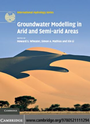
Groundwater Modelling in Arid and Semi-Arid Areas
Preface
Arid and semi-arid regions present special challenges for water
management. They are, by definition, areas where water is at its
most scarce, and face great pressures to deliver and manage
freshwater resources. Demand for water has increased dramatically, due to population growth, increasing expectations for
domestic water use, and expansion of industrial and agricultural
activities. Available water resources have been reduced by
pollution and over-abstraction. Many of the world’s arid regions
are further threatened by climate change.
Subscribe to:
Comments (Atom)
Labels of Contents
Applied Geomorphology
(3)
Article
(12)
Atmosphere
(1)
Book
(124)
Cartography
(2)
Civil Engineering
(1)
Data Analysis
(1)
Data Mining
(2)
Dictionary of Earth Science
(1)
Disaster Management Book
(5)
Engineering Geology
(8)
Environment
(7)
Folds
(1)
GIS
(75)
GRASS GIS
(3)
Geoinformatics
(1)
Geology
(31)
Geomorphology
(3)
Global Mapper 19
(1)
Global Mapper 20
(1)
Golden Software Surfer 13. Video
(1)
Ground Water Geology
(3)
Hydrology
(17)
Image Interpretation
(9)
Landslide
(3)
MATLAB
(2)
MODFLOW
(1)
Machine Learning
(1)
Mapping
(10)
Microsoft Excel Tutorial
(1)
Mineralogy
(2)
Modeling
(8)
PCI GEOMATICA 2016
(1)
PDF eBook
(31)
Petrology
(2)
Processing
(4)
QGIS Training
(15)
R
(1)
Remote sensing
(64)
Research Methodology
(1)
Rockwork 16
(2)
SAGA GIS
(1)
SAS Planet
(1)
Sedimentology
(3)
Soil
(6)
Song
(1)
Starter 5
(1)
Suitability Analysis using Model Builder ArcGIS 10
(1)
Technical Report
(3)
Training Manual
(20)
Tutorial
(21)
Video
(13)
Water Resources
(14)
arcgis for local government
(1)
arcgis online web app
(1)
coastal Geology
(1)
esri arcmap
(1)
esri business analyst
(1)
esri data
(1)
esri earth
(1)
esri local government
(1)
esri platform
(1)
esri software
(1)
esri tools
(1)
ezri gis
(1)
geonet esri
(1)
maximo gis
(1)
pdf
(140)
software
(12)
structural Geology
(7)
web GIS
(2)


