

Showing posts with label structural Geology. Show all posts
Showing posts with label structural Geology. Show all posts
Tuesday, 3 January 2023
Beautiful Columnar Basalt, Symphony of the Stone, Yerevan, Armenia
Beautiful Columnar Basalt,
Symphony of the Stone, Yerevan, Armenia
Situated about 23 km east of Yerevan, Armenia, just below the village of the same name, lies the breathtaking Garni Gorge, with cliff walls of well-preserved basalt columns carved out by the Goght River on its sides. This part of the gorge is known as the “Symphony of the Stones,”. The columns suspended against gravity resemble an organ, which explains why the natural monument is also called the “Basalt Organ”. The soundtrack is provided by the river that flows through the gorge and fills the splendor of the stone with the symphony of water. The organ is made up of enormous symmetrical hexagonal and pentagonal basalt columns (almost 50 meters high), which appear to be handcrafted due to their extraordinary symmetry.
 These amazing rock formations were formed under high pressure conditions due to the cooling and crystallization of volcanic lava.The complex topography of Armenia was shaped by a geological upheaval that pushed up the Earth’s crust to form the Armenian Plateau 25 million years ago. How exactly the columnar jointing was formed is still uncertain, but it is usually explained by analogy with mud-cracks resulting from shrinkage at the surface of dried-up mud. The polygonal cracks in basalt are presumed to be due to contraction during cooling, which acts towards the creation of a series of equally spaced cooling centers. A tension crack is thought to form between two centers and since each center is surrounded by many others, a multi-sided polygonal crack system is formed, splitting the rock into roughly uniform polygonal blocks. As cooling proceeds towards the interior, cracks propagate inward at right angles to the cooling surface, resulting in the distinctive columnar structure.
#Geology #geology #geologyrocks #earthscience #geologist #geoscience #geosciencenetwork
Image credit: @globetolter[IG
These amazing rock formations were formed under high pressure conditions due to the cooling and crystallization of volcanic lava.The complex topography of Armenia was shaped by a geological upheaval that pushed up the Earth’s crust to form the Armenian Plateau 25 million years ago. How exactly the columnar jointing was formed is still uncertain, but it is usually explained by analogy with mud-cracks resulting from shrinkage at the surface of dried-up mud. The polygonal cracks in basalt are presumed to be due to contraction during cooling, which acts towards the creation of a series of equally spaced cooling centers. A tension crack is thought to form between two centers and since each center is surrounded by many others, a multi-sided polygonal crack system is formed, splitting the rock into roughly uniform polygonal blocks. As cooling proceeds towards the interior, cracks propagate inward at right angles to the cooling surface, resulting in the distinctive columnar structure.
#Geology #geology #geologyrocks #earthscience #geologist #geoscience #geosciencenetwork
Image credit: @globetolter[IG

Saturday, 4 April 2020
Unconformity, Disconformities and Nonconformities in Structural Geology
What is Unconformity, Disconformities and Nonconformities in Structural Geology?
Unconformity
An unconformity is a contact between two rock units in which the upper unit is usually much younger than the lower unit . Unconformities are typically buried erosional surfaces that can represent a break in the geologic record of hundreds of millions of years or more .
For example, the contact between a 400-million-year-old sandstone that was deposited by a rising sea on a weathered bedrock surface that is 600 million years old is an unconformity that represents a time hiatus of 200 million years.
Monday, 2 March 2020
Fault and Fault Terminology in Geology
What is Fault in Geology?
A fault is a fracture or region of fractures between two blocks of rock. Faults enable the blocks to pass relative to every other. This motion may appear rapidly, in the form of an earthquake - or may also happen slowly, in the shape of creep.
 |
| Figure 1 Types of faulting in tectonic earthquakes, Publisher Encyclopædia Britannica, 2015 |
Faults may additionally vary in size from a few millimeters to thousands of kilometers. Most faults produce repeated displacements over geologic time. During an earthquake, the rock on one side of the fault suddenly slips with respect to the other. The fault surface can be horizontal or vertical or some arbitrary attitude in between.
Earth scientists use the angle of the fault with respect to the surface (known as the dip) and the direction of slip alongside the fault to classify faults. Faults which move along the direction of the dip airplane are dip-slip faults and described as either ordinary or reverse (thrust), depending on their motion. Faults which cross horizontally are regarded as strike-slip faults and are categorized as both right-lateral or left-lateral. Faults which exhibit each dip-slip and strike-slip action are recognized as oblique-slip faults.
Thursday, 20 February 2020
What are the Geological Folds and its Type and components?
What are the Geological Folds?
A fold
is a structural
feature that is formed when planar surfaces are bent or curved. Geological folds are the curvatures in rocks or strata containing them. Stratified rocks were originally formed from sediments that were deposited in flat horizontal sheets, but in a number of places the strata are no longer horizontal but have been warped.
Thursday, 12 September 2019
Fundamentals of Structural Geology, PDF eBook
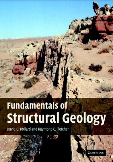 |
| Fundamentals of Structural Geology |
Download Link Given Below
Fundamentals of Structural Geology provides a new framework for the investigation of geological structures by integrating field mapping and mechanical analysis. It emphasizes the observational data, modern mapping technology, principles of continuum mechanics, and the mathematical and computational skills, necessary to map, describe, model, and explain deformation in the Earth’s lithosphere quantitatively.
Tuesday, 23 July 2019
STRUCTURAL GEOLOGY An Introduction to Geometrical Techniques

Preface
The first steps in the study of geological structures are largely geometrical. This is true
in the historical development of our knowledge of such structures, in the initial stages of
any field investigation, and in the education of a structural geologist. This concern for
geometry includes the methods of describing and illustrating the form and orientation of
geological structures, and the solution of various dimensional aspects of these structures.
Subscribe to:
Posts (Atom)
Subscribe


 Posts
All Comments
Posts
All Comments