Open PDF and Software Resources of Earth-sciences, Remote Sensing and Geographic Information System.
Showing posts with label QGIS Training. Show all posts
Showing posts with label QGIS Training. Show all posts
Saturday, 11 December 2021
Monday, 8 July 2019
Practical GIS- Use Tools Such as QGIS, PostGIS and GeoServer to Build Powerful GIS Solution.
Preface
In the past, professional spatial analysis in the business sector was equivalent to buying an
ArcGIS license, storing the data in some kind of Esri database, and publishing results with
the ArcGIS Server. These trends seem to be changing in the favor of open source software.
Thursday, 2 May 2019
QGIS and Applications in Water and Risks
Contents
Introduction . . . . . . . . . . . . . . . . . . . . . . . . . . . . . . . . . . . . . . . xi
Chapter 1. Monitoring Coastal Bathymetry Using Multispectral Satellite Images at High Spatial Resolution . . . . . . . 1
Bertrand LUBAC
Thursday, 4 April 2019
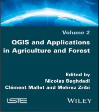
QGIS and Applications in Agriculture and Forest
Volume 2
Edited by
Nicolas Baghdadi
Clément Mallet
Mehrez Zribi
Introduction
Agriculture and forestry are fields strongly involved in the use of spatial data,
which are essential for monitoring and restoring the spatial and temporal variability
of surface states. The latter are key parameters in the understanding and modeling of
different plant and soil processes, and in the management of agricultural or forest
resources. A very good knowledge of these environments is therefore fundamental
both from an economic and ecological point of view. Remote sensing, thanks to the
great diversity of spatial (from precision agriculture to global crop monitoring),
spectral (active and passive sensors) and temporal (from rapid mapping to annual
crop monitoring) resolutions, has become an inevitable support to address these
issues. In this context, the use of Geographic Information System (GIS) tools has
long been present in accompanying the exploitation of spatial imagery.
Thursday, 28 March 2019
Training Manual-Community Mapping and QGIS
A climate and disaster risk mapping
toolkit for local communities
This document is a guide on the application of
QGIS in community mapping. It aims to help
communities understand the risks, vulnerabilities
and their location in their communities. Communities
can use it to collect, edit, store and display data
from their communities.
Created by: Siu I Fanga Pouvalu.
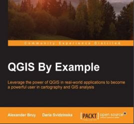
QGIS By Example
Preface
Welcome to QGIS By Example. This book will help you understand the capabilities of QGIS, show you how to work with spatial data and perform the most common analyses, and bring your productivity to a new level with the Processing framework.
Building Mapping Applications with QGIS
Preface of the Book
As software applications become more and more a part of people's lives, the concepts of location and space become more important. Developers are regularly finding themselves having to work with location-based data. Maps, geospatial data, and spatial calculations are increasingly becoming just another part of the everyday programming repertoire.
Monday, 25 March 2019
Qgis Tutorial eBook-Introduction to basic GIS and spatial analysis using QGIS.
This set of training modules was developed by the International Maize and Wheat
Improvement Center (CIMMYT) as part of the Cereal Systems Initiative for South Asia
(CSISA) project. Published in 2018.
Correct Citation: Ahmed, Z.U., Krupnik, T.J., Kamal, M., 2018. Introduction to basic GIS
and spatial analysis using QGIS: Applications in Bangladesh. Cereal Systems Initiative for South
Asia (CSISA) and the International Maize and Wheat Improvement Center, CIMMYT. Dhaka,
Bangladesh.
Monday, 18 March 2019
QGIS Training Manual Release 3.4
Background
In 2008 we launched the Gentle Introduction to GIS, a completely free, open content resource for people who
want to learn about GIS without being overloaded with jargon and new terminology. It was sponsored by the
South African government and has been a phenomenal success, with people all over the world writing to us to
tell us how they are using the materials to run University Training Courses, teach themselves GIS and so on.
Wednesday, 13 March 2019
QGIS User Guide, Release 2.18
Foreword
QGIS is an Open Source Geographic Information System. The project was born in May of 2002 and was established as a project on Source Forge in June of the same year. We’ve worked hard to make GIS software (which
is traditionally expensive proprietary software) a viable prospect for anyone with basic access to a personal computer. QGIS currently runs on most Unix platforms, Windows, and macOS. QGIS is developed using the Qt toolkit
(https://www.qt.io) and C++. This means that QGIS feels snappy and has a pleasing, easy-to-use graphical user
interface (GUI)
Monday, 4 March 2019
Semi-Automatic Classification Plugin for Qgis
Version 5.3.6.1
| SCP |
Developed by Luca Congedo, the Semi-Automatic Classification Plugin (SCP) is a free open source plugin for QGIS that allows for the semi-automatic classification (also known as supervised classification) of remote sensing images.
 |
| SCP |
It provides several tools for the download of free images, the preprocessing, the postprocessing, and the
raster calculation (please see What can I do with the SCP ? (page 257)).
The overall objective of SCP is to provide a set of intertwined tools for raster processing in order to make an
automatic workflow and ease the land cover classification, which could be performed also by people whose main
field is not remote sensing.
Monday, 25 February 2019
Land Cover Mapping and Classification Accuracy Assessment in QGIS
construct
a single-date land cover map by classification of a cloud-free composite generated from Landsat images;
and complete an accuracy assessment of the map output. The tools for completing this work will be
done using a suite of open-source tools, mostly focusing on QGIS.
The land cover map will be created by training a machine learning algorithm, random forests, to predict land cover across the landscape. The random forests model is trained from a user generated reference data set – collected either in the field or manually through examination of remotely sensed data sources.
The resulting model is then applied across the landscape. Finally you will assess agreement with a second reference data set generated using a stratified random sampling process and high resolution aerial imagery.
The reference data set will be compared to the classified map image to determine the accuracy estimates. Modules 3 and 4 have been adapted from Exercises and material developed by Dr. Pontus Olofsson, Christopher E. Holden, and Eric L. Bullock at the Boston Education in Earth Observation Data Analysis in the Department of Earth & Environment, Boston University. To learn more about their materials and
their work, visit their github site at https://github.com/beeoda
Introduction
The tools for completing the workflow in this module are all open-source; QGIS is the primary tool used to complete both the land cover map and land cover change map workflow. A QGIS install was created from the OSGeo4W and is included on the website for download.
It includes these additional packages:
GDAL
Orfeo ToolBox
QGIS
Python
Objectives
Explore the QGIS Terminal
Create a false color image from the SWIR, NIR, and Red bands from the cloud free Landsat composite image,
Stack image bands, and
Do some basic image band arithmetic.
Download Link
Wednesday, 23 January 2019
QGIS Tutorial for Agrometeorological Practice
QGIS Tutorial for Agrometeorological Practice
The International Workshop on
Agromet and GIS Applications
for Agricultural Decision Making
Date : December 5(Mon)~9(Fri), 2016
Place : MSTAY Hotel JEJU
Monday, 21 January 2019
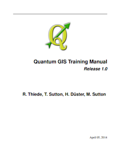
Free Download QGIS Training Manual
This training manual is intended to provide all the materials needed to run a 5 day course on QGIS, PostgreSQL and PostGIS. The course is structured with content to suit novice, intermediate and advanced users alike and has many exercises complete with annotated answers throughout the text.
Download Link
Exercises Open Source Software for Preprocessing GIS Data for Hydrological Models
Preface
A Geographic Information System (GIS) can be a useful tool for preparing the input of models and
tools. Furthermore, in this era of Open Data ample open access data is available that can easily be
retrieved from the internet and integrated in open source desktop GIS software, such as QGIS.
These exercises will guide you through different steps that are needed to preprocess data to be used
in models and tools. In the first exercise you will learn how to register a scanned topographic map
and use it as a backdrop for digitizing vector data.
In the second exercise you will learn how to import
data from spreadsheets into a GIS and to use it to join tables, manipulate the attribute table and
interpolating the data to a continuous raster layer. In the third exercise you will download open
access data from Open Street Map and use it for further analysis and conversion. The geodatabase will
also be introduced in this exercise. In the fourth exercise you will use map algebra for spatial
planning.
Finally, you will learn how to delineate catchments and streams form digital elevation
models and to present them in maps or in an interactive web page.
The exercises have been developed for different MSc programmes at IHE Delft and tailor made
training in Uganda, financed by the Vitens Evides International (VEI) fund.
Learning objectives
After following this step-by-step tutorial you will be able to:
Use QGIS in its main functionalities, also in conjunction with plugins
Digitize features from a scanned map or satellite image
Import tabular data in a GIS
Do simple vector analysis
Interpolate point data
Convert vector and raster data
Reproject vector and raster data
Use map algebra
Use online data
Perform catchment and stream delineation
Software requirements
During the next exercises we will make use of the following software:
QGIS ver 2.18.11 (Las Palmas) or higher,
Google Earth,
Firefox Mozilla
MS Excel or OpenOffice Calc
Preparation
The exercises have been tested for QGIS 2.18.11.
1) Download QGIS from http://www.qgis.org/en/site/forusers/download.html
2) Install QGIS
3) Install the exercise data from http://ocw.unesco-ihe.org
Download Link
Subscribe to:
Posts (Atom)
Labels of Contents
Applied Geomorphology
(3)
Article
(12)
Atmosphere
(1)
Book
(124)
Cartography
(2)
Civil Engineering
(1)
Data Analysis
(1)
Data Mining
(2)
Dictionary of Earth Science
(1)
Disaster Management Book
(5)
Engineering Geology
(8)
Environment
(7)
Folds
(1)
GIS
(75)
GRASS GIS
(3)
Geoinformatics
(1)
Geology
(31)
Geomorphology
(3)
Global Mapper 19
(1)
Global Mapper 20
(1)
Golden Software Surfer 13. Video
(1)
Ground Water Geology
(3)
Hydrology
(17)
Image Interpretation
(9)
Landslide
(3)
MATLAB
(2)
MODFLOW
(1)
Machine Learning
(1)
Mapping
(10)
Microsoft Excel Tutorial
(1)
Mineralogy
(2)
Modeling
(8)
PCI GEOMATICA 2016
(1)
PDF eBook
(31)
Petrology
(2)
Processing
(4)
QGIS Training
(15)
R
(1)
Remote sensing
(64)
Research Methodology
(1)
Rockwork 16
(2)
SAGA GIS
(1)
SAS Planet
(1)
Sedimentology
(3)
Soil
(6)
Song
(1)
Starter 5
(1)
Suitability Analysis using Model Builder ArcGIS 10
(1)
Technical Report
(3)
Training Manual
(20)
Tutorial
(21)
Video
(13)
Water Resources
(14)
arcgis for local government
(1)
arcgis online web app
(1)
coastal Geology
(1)
esri arcmap
(1)
esri business analyst
(1)
esri data
(1)
esri earth
(1)
esri local government
(1)
esri platform
(1)
esri software
(1)
esri tools
(1)
ezri gis
(1)
geonet esri
(1)
maximo gis
(1)
pdf
(140)
software
(12)
structural Geology
(7)
web GIS
(2)


