Georsgis Blog

↑ Grab this Headline Animator

Thursday, 28 March 2019

Training Manual-Community Mapping and QGIS


A climate and disaster risk mapping toolkit for local communities
Training Manual-Community Mapping and QGIS


This document is a guide on the application of QGIS in community mapping. It aims to help communities understand the risks, vulnerabilities and their location in their communities. Communities can use it to collect, edit, store and display data from their communities. Created by: Siu I Fanga Pouvalu.

Microsoft Excel 2016 Step by Step


Microsoft Excel 2016 Step by Step


Introduction


This Step by Step book has been designed so you can read it from the beginning to learn about Microsoft Excel 2016 and then build your skills as you learn to perform increasingly specialized procedures. Or, if you prefer, you can jump in wherever you need ready guidance for performing tasks. The how-to steps are delivered crisply and concisely just the facts. You’ll also find informative, full-color graphics that support the instructional content.

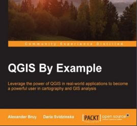
QGIS By Example


QGIS By Example


Preface 

Welcome to QGIS By Example. This book will help you understand the capabilities of QGIS, show you how to work with spatial data and perform the most common analyses, and bring your productivity to a new level with the Processing framework. 


Building Mapping Applications with QGIS


Building Mapping Applications with QGIS


Preface of the Book
As software applications become more and more a part of people's lives, the concepts of location and space become more important. Developers are regularly finding themselves having to work with location-based data. Maps, geospatial data, and spatial calculations are increasingly becoming just another part of the everyday programming repertoire.

Monday, 25 March 2019

Ebook-Environmental Applications of Remote Sensing


Environmental Applications of Remote Sensing


This book contains high quality and compressive work on both microwave and optical remote sensing applications. 

This book is divided into five sections: 
(i) remote sensing for biomass estimation, 
(ii) remote sensing-based glacier studies, 
(iii) remote sensing for coastal and ocean applications, 
(iv) sewage leaks and environment disasters, and 
(v) remote sensing image processing.

Qgis Tutorial eBook-Introduction to basic GIS and spatial analysis using QGIS.


Introduction to basic GIS and spatial analysis using QGIS:  Applications in Bangladesh


This set of training modules was developed by the International Maize and Wheat Improvement Center (CIMMYT) as part of the Cereal Systems Initiative for South Asia (CSISA) project. Published in 2018.


Correct Citation: Ahmed, Z.U., Krupnik, T.J., Kamal, M., 2018. Introduction to basic GIS and spatial analysis using QGIS: Applications in Bangladesh. Cereal Systems Initiative for South Asia (CSISA) and the International Maize and Wheat Improvement Center, CIMMYT. Dhaka, Bangladesh. 

Sunday, 24 March 2019

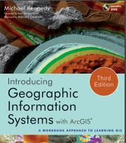
Introducing Geographic Information Systems with ArcGIS


Introducing Geographic Information Systems with ArcGIS


Foreword by Jack Dangermond

Introducing Geographic Information Systems with ArcGIS offers a unique approach to GIS instruction. In it, Michael Kennedy re-creates his time-tested methods of teaching GIS in the classroom in a step-by-step guidebook to GIS. Students on a journey to learn GIS with Professor Kennedy may feel like he is taking the journey with them, offering them his sage advice each step of the way.

Saturday, 23 March 2019

SOIL EROSION AND CONSERVATION


Preface of the Book

Soil erosion is a hazard traditionally associated with agriculture in tropical and semi-arid areas and is important for its long-term effects on soil productivity and sustainable agriculture. It is, however, a problem of wider significance occurring additionally on land devoted to forestry, transport and recreation. Erosion also leads to environmental damage through sedimentation,

Friday, 22 March 2019

Spatial Analytics with ArcGIS


PREFACE OF THE BOOK

The Spatial Statistics toolbox in ArcGIS contains a set of tools for analyzing spatial distributions, patterns, processes, and relationships. While similar to traditional statistics, spatial statistics are a unique set of analyses that incorporate geography. These tools can be used with all license levels of ArcGIS Desktop and are a unique way of exploring the spatial relationships inherent in your data. In addition to using ArcBridge, the R programming language can now be used with ArcGIS Desktop to provide customized statistical analysis and tools. 


Wednesday, 20 March 2019

Advances in Remote Sensing and GIS applications in Forest Fire Management From local to global assessments


Preface
The importance of wildfires as a natural or a human-induced phenomenon has gained importance at regional and global levels in the last years. Improved remote sensing and computational capabilities enable the fast processing of large image datasets in real time. As a result, remote sensing and geographic information systems are today, more than ever before, common tools for fire monitoring at local, regional and global levels. However, the gap between research and operational use of remote sensing and GIS still exists.

Tuesday, 19 March 2019

GIS, Environmental Modeling and Engineering


Description:


Spatial dimensions need to be properly captured if modeling and engineering techniques are to be successfully applied in addressing environmental problems. The links between the geographical information systems (GIS) that capture this data, simulation modeling, and engineering offer tremendous possibilities for building versatile support systems for managing the environment. 

Monday, 18 March 2019

QGIS Training Manual Release 3.4


Background
In 2008 we launched the Gentle Introduction to GIS, a completely free, open content resource for people who want to learn about GIS without being overloaded with jargon and new terminology. It was sponsored by the South African government and has been a phenomenal success, with people all over the world writing to us to tell us how they are using the materials to run University Training Courses, teach themselves GIS and so on.

Engineering rock mechanics

An introduction to the principles 

Preface of the Book
With the title Engineering Rock Mechanics, what is this book about? It is about the discipline, based on mechanics, which is used to design structures built on or in rock masses. These structures, which encompass building foundations, dams, rock slopes, tunnel, caverns, hydroelectric schemes, mines, etc., depend critically on the rock mass properties and the interaction between the rock mass and the engineered structure. As a result, the distinct discipline of engineering rock mechanics has developed. The term ’rock mechanics’ refers to the basic science of mechanics applied to rocks; whilst the term ’rock engineering’ refers to any engineering activity involving rocks.

Map Accuracy Assessment and Area Estimation: A Practical Guide


Introduction

Accurate and consistent information on forest area and forest area change is important given the reporting requirements for countries to access results based payments for REDD+1 . Forest area change
estimates usually provide data on the extent of human activity resulting in emissions (e.g. from deforestation) or removals (e.g. from afforestation), also called activity data (AD). A basic methodological approach to estimate greenhouse gas emissions and removals (IPCC, 2003), is to multiply AD with a coefficient that quantifies emissions per unit ‘activity’ (e.g. tCO2e per ha), also called an emission factor (EF)

Handbook on remote sensing for agricultural statistics


Over View of the Book


Chapter 1 describes the data sets relevant to the integration of remote sensing within agricultural statistics. First, the remote sensing data sources themselves will be addressed. The role of reference data and ancillary data layers, and their use in stratification and aggregation, will also be discussed. A key issue arising recently in data access is the general trend towards open access. Thus, while the major commercial remote sensing missions will be listed for reference, attention will be paid to open-access sources for a number of reasons: (1) to create wider awareness on data sets that are available under free and open licenses;

Saturday, 16 March 2019

DIGITAL TERRAIN MODELING Principles and Methodology


Preface of the Book
Terrain models have always appealed to military personnel, planners, landscape architects, civil engineers, as well as other experts in various earth sciences. Originally, terrain models were physical models, made of rubber, plastic, clay, sand, etc. Since the later 1950s, the computer has been introduced into this area and the modeling of terrain surface has since then been carried out numerically or digitally, leading to the current discipline — digital terrain modeling.

Friday, 15 March 2019

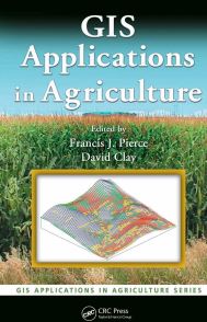
GIS Applications in Agriculture


Preface of the Book
Agriculture is a business sector ideally suited for the application of Geographic Information Systems (GIS) because it is natural resource based, requires the movement, distribution, and/or utilization of large quantities of products, goods, and services, and is increasingly required to record details of its business operations from the field to the marketplace.

Wednesday, 13 March 2019

QGIS User Guide, Release 2.18


Foreword
QGIS is an Open Source Geographic Information System. The project was born in May of 2002 and was established as a project on Source Forge in June of the same year. We’ve worked hard to make GIS software (which is traditionally expensive proprietary software) a viable prospect for anyone with basic access to a personal computer. QGIS currently runs on most Unix platforms, Windows, and macOS. QGIS is developed using the Qt toolkit (https://www.qt.io) and C++. This means that QGIS feels snappy and has a pleasing, easy-to-use graphical user interface (GUI)

The ArcGIS Imagery Book


How this book works

The purpose of this book is to show you—the GIS professional, app developer, web designer, or virtually any other type of technologist—how to become a GIS and imagery ace. Or put another way, to become someone who is a smarter, more skillful, and more powerful applier of image data within a GIS. Imagery is suddenly a big deal, and those who are adept at finding it, analyzing it, and understanding what it actually means are going to be in demand in the years ahead

SAGA GIS Manual-Satellite Image Analysis and Terrain Modelling


This training manual has been developed with support from the Australian government via funding provided through their Artisanal and Small-scale Mining for Development project being implemented by Charles Darwin University. This project has been run and the material for this manual developed in collaboration between three universities in Eastern Indonesia and Australia 1) Charles Darwin University (Darwin), 2) UNDANA University (Kupang) and 3) Haluoleo University (Kendari – South East Sulawesi).

Tuesday, 12 March 2019

CAD and GIS Integration

Preface


The need for CAD/GIS integration arises in many applications. Integration of computer-aided design (CAD) and geospatial information systems (GIS) can reduce many inefficiencies and errors made during design, planning, and execution of a project. 

CAD and GIS 


It can also streamline decision making during operations. Many tasks, in particular engineering tasks in design, construction, and asset management throughout the life-cycle of an infrastructure or a facility, require knowledge of and skills in several interrelated and yet disconnected task-specific software and tools. CAD and GIS were developed separately, with decades of standalone existence. They have traditionally been used in tandem for making crucial decisions in

Remote Sensing and GIS Accuracy Assessment


Preface of the Book

The development of robust accuracy assessment methods for the validation of spatial data represents a difficult challenge for the geospatial science community. The importance and timeliness of this issue are related directly to the dramatic escalation in the development and application of spatial data throughout the latter 20th century. This trend, which is expected to continue, will become increasingly pervasive and continue to revolutionize future decision-making processes.

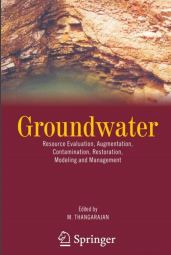
Groundwater Resource Evaluation

Resource Evaluation, Augmentation, Contamination, Restoration, Modeling and Management
Ground Water

Preface of the Book
Groundwater plays a major role in the livelihood of mankind by providing water for drinking, irrigation and industrial purposes. The rapid population growth in the last three decades all over the globe resulted in exploiting more groundwater. The distribution of groundwater—both in space and time— is more erratic as it depends on the subsurface geological and climatic conditions. In many countries, the decline of water level indicates that the resources are depleted very fast. 

It is, therefore, necessary to assess the available subsurface resource in a more judicious scientific manner and then apply it for evolving optimal utilization purposes. There is an urgent need to have a comprehensive book, which contains the entire spectrum of groundwater assessment and management aspects. I had seen many books, which cover only the specific aspects on groundwater exploration, exploitation, augmentation, pollution and remediation and mathematical modeling but not many books on the integrated aspects of all. It was, therefore, planned to bring a book, which covers the above said aspects by inviting specific topics from various experts of the globe. 

Monday, 11 March 2019

Data Mining Practical Machine Learning Tools and Techniques


Data Mining Practical Machine Learning Tools and Techniques

Foreword

Technology now allows us to capture and store vast quantities of data. Finding patterns, trends, and anomalies in these datasets, and summarizing them with simple quantitative models, is one of the grand challenges of the information age—turning data into information and turning information into knowledge. There has been stunning progress in data mining and machine learning.

Remote Sensing in an ArcMap Environment

Tutorial eBook Remote Sensing in an ArcMap Environment


Introduction to this Manual

This manual, and associated videos, introduce users of ArcGIS to image analysis capabilities, now available in ESRI’s ArcGIS 10.X versions. The user does not need prior knowledge of ArcGIS as we provide a review ArcMap and ArcCatalog basics, although prior knowledge of ArcGIS is helpful.

Friday, 8 March 2019

PRACTICAL MATLAB APPLICATIONS FOR ENGINEERS


Practical MATLAB® Applications for Engineers introduces the reader to the concepts of MATLAB® tools used in the solution of advanced engineering course work followed by engineering and technology students. Every chapter of this book discusses the course material used to illustrate the direct connection between the theory and real-world applications encountered in the typical engineering and technology programs at most colleges. Every chapter has a section, titled Background, in which the basic concepts are introduced and a section in which those concepts are tested, with the objective of exploring a number of worked-out examples that demonstrate and illustrate various classes of real-world problems and its solutions

Wednesday, 6 March 2019

How to Install ArcGIS 10.5 without license file


Download link given below


Follow the Step


Step-1 Install ArcGIS_Desktop 10.5


After install automatically open a License Administrator Window. You just close it.


Book-Sedimentology and Stratigraphy

Introduction: Sedimentology and Stratigraphy

Sedimentology is the study of the processes of formation, transport and deposition of material that accumulates as sediment in continental and marine environments and eventually forms sedimentary rocks. 
Sedimentology and Stratigraphy

Stratigraphy is the study of rocks to determine the order and timing of events in Earth history: it provides the time frame that allows us to interpret sedimentary rocks in terms of dynamic evolving environments. The stratigraphic record of sedimentary rocks is the fundamental database for understanding the evolution of life, plate tectonics through time and global climate change.

Principles of Geotechnical Engineering by BRAJA M. DAS, Seventh Edition

Principle of Geotechnical Engineering,7th edition


This new edition offers an overview of soil properties and mechanics, together with coverage of field Prentice's and basic engineering procedures without changing the basic philosophy in which the text was written originally.


Preface of the Book

Principles of Geo technical Engineering was originally published with a 1985 copyright and was intended for use as a text for the introductory course in geotechnical engineering taken by practically all civil engineering students, as well as for use as a reference book for practicing engineers. The book was revised in 1990, 1994, 1998, 2002, and 2006. 

This Seventh Edition is the twenty-fifth anniversary edition of the text. As in the previous editions of the book, this new edition offers an overview of soil properties and mechanics, together with coverage of field Prentice's and basic engineering procedures without changing the basic philosophy in which the text was written originally.

Tuesday, 5 March 2019

PETROLOGY OF SEDIMENTARY ROCKS


Petrology of Sedimentary Rock


This book emphasizes the properties of sedimentary rocks rather than sedimentary processes. Thus, it focuses on description and discussion of mineralogic and chemical composition, as well as the textures and sedimentary structures that characterize sedimentary rocks.

SECOND EDITION, by Sam Bogs,Jr


Preface of the Book

As indicated in the first edition, this book emphasizes the properties of sedimentary rocks rather than sedimentary processes. Thus, it focuses on description and discussion of mineralogic and chemical composition, as well as the textures and sedimentary structures that characterize sedimentary rocks. 


Further, it discusses application of insights derived from study of rock properties to interpretation of their origin, including provenance (sediment source), depositional environments, and diagenesis. 


Part I of the book deals with basic principles related to the origin, classification and occurrence of sedimentary rocks. Part II describes and discusses the siliciclastic sedimentary rocks such as sandstones. 


Part III describes the carbonate sedimentary rocks (e.g. limestones), and Part IV discusses other chemical sedimentary rocks and carbonaceous sedimentary rocks such as oil shales. The book is aimed at advanced undergraduate and graduate students; however, professional geologists may also find the book useful.

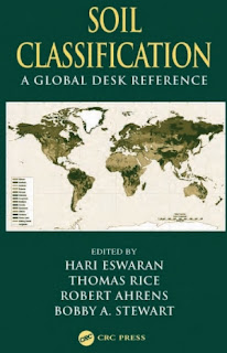
Book-Soil Classification-A Global Desk Reference

Soil Classification

Content of the Book

CHAPTER 1 Philosophies of Soil Classifications: From Is to Does

CHAPTER 2 How Good Is Our Soil Classification?

CHAPTER 3 Soil Classification: Past and Present
CHAPTER 4 Conceptual Basis for Soil Classification: Lessons from the Past

CHAPTER 5 Soil Classification and Soil Research
CHAPTER 6 Back to the Old Paradigms of Soil Classification
CHAPTER 7 Incorporating Anthropogenic Processes in Soil Classification

CHAPTER 8 Developments in Soil Chemistry and Soil Classification
PART 2 Developments in Classification Systems
 CHAPTER 9 Demands on Soil Classification in Australia
CHAPTER 10 Development of Soil Classification in China

CHAPTER 11 The Brazilian Soil Classification System
CHAPTER 12 The Future of the FAO Legend and the FAO/UNESCO Soil Map of the World
CHAPTER 13 The Current French Approach to a Soilscapes Typology
CHAPTER 14 New Zealand Soil Classification—Purposes and Principles

CHAPTER 15 Changing Concepts of Soil and Soil Classification in Russia
CHAPTER 16 Advances in the South African Soil Classification System
CHAPTER 17 Soil Taxonomy and Soil Survey
CHAPTER 18 Classification of Soils of the Tropics: A Reassessment of Soil Taxonomy
CHAPTER 19 Anticipated Developments of the World Reference Base for Soil Resources

Download Link

Essential Image Processing and GIS for Remote Sensing


Essential Image Processing and GIS


Overview of the Book

From an applied viewpoint, and mainly for Earth observation, remote sensing is a tool for collecting raster data or images. Remotely sensed images represent an objective record of the spectrum relating to the physical properties and chemical composition of the Earth surface materials. Extracting information from images is, on the other hand, a subjective process. People with differing application foci will derive very different thematic information from the same source image.

Monday, 4 March 2019

Hydrology in Practice

Hydrology in Practice

Third edition , Elizabeth M.Shaw Formerly of the Department of Civil Engineering Imperial College of Science, Technology and Medicine  


Preface to the Third Edition 
In the current critical concern for the well-being of the environment, hydrologists in practice are finding the need for information on many more related topics.
The course contents in universities and other training establishments are developing a wider appreciation of the scope of hydrology and requests for the inclusion of such allied subjects as climatic change, sediment transport and catchment morphometry have been indicated. Without changing the structure of the text, brief introductions to these subjects with accompanying references have been inserted where practicable.
The major revisions have resulted from the technological advances in instrumentation and the philosophical changes in data processing. The original aims in handling hydrological measurements were to automate quality control and analysis with complex statistical programs on large-capacity mainframe computers. With desktop personal microcomputers, linked to field instruments and mainframe, the skilled meteorologist or hydrologist can make experienced subjective judgement on the data from elaborate displays of back-up related information.

GRASS GIS Tutorial Vector and Imagery Commands

GRASS Introduction 

GRASS (Geographic Resources Analysis Support System) is a raster based GIS, vector GIS, image processing system, and graphics production system.


GRASS Ref. Manual
GRASS contains over 200 programs and tools
to render maps and images on monitor and paper; manipulate raster, vector, and sites data; process multispectral image data; and create, manage, and store spatial data. GRASS uses both an intuitive windows interface as well as command line syntax for ease of operations. GRASS can interface with commercial printers, plotters, digitizers, and databases to develop new data as well as manage existing data. GRASS is ideal for use in engineering and land planning applications.

Semi-Automatic Classification Plugin for Qgis

Version 5.3.6.1


SCP

Developed by Luca Congedo, the Semi-Automatic Classification Plugin (SCP) is a free open source plugin for QGIS that allows for the semi-automatic classification (also known as supervised classification) of remote sensing images. 

SCP


It provides several tools for the download of free images, the preprocessing, the postprocessing, and the raster calculation (please see What can I do with the SCP ? (page 257)). The overall objective of SCP is to provide a set of intertwined tools for raster processing in order to make an automatic workflow and ease the land cover classification, which could be performed also by people whose main field is not remote sensing. 

Sunday, 3 March 2019

Imagery and GIS

Best Practices for Extracting Information from Imagery

Introduction 


Why Imagery and GIS? Imagery—it allures and fascinates us; its measurements inform us. It draws us in to explore, analyze, and understand our world.
Imagery and GIS


 First comes the astonishment of its raw beauty—the enormity of a hurricane, the stark glaciers in Greenland, the delicate branching of a redwood’s lidar profile, a jagged edge of a fault line in radar, the vivid greens of the tropics, the determined lines of human impact, the rebirth of Mount Saint Helens’ forests, the jiggly wiggly croplands of Asia and Africa, the lost snows of Kilimanjaro. Each image entices us to discover more, to look again and again. Then we start to ask questions. Why do trees no longer grow here? Can trees grow here again? How much has this city expanded?

Mastering ArcGIS

Mastering the Concepts 

GIS Concepts Representing real-world objects on maps To work with maps on a computer requires developing methods to store different types of map data and the information associated with them. Map data fall into two categories: discrete and continuous. 
Mastering ArcGIS 


Discrete data are objects in the real world with specific locations or boundaries, such as cities, roads, or soils units. Continuous data represent a quantity that is measured and recorded everywhere over a surface, such as temperature or elevation.

Contact us

Name

Email *

Message *

Follow us on Facebook and YouTube