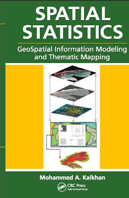
The focus of the book remains straightforward linear geostatistics based on least-squares estimation. The theory and techniques have been around in mineral exploration and petroleum engineering for some four decades.
Open PDF and Software Resources of Earth-sciences, Remote Sensing and Geographic Information System.
Tuesday, 30 April 2019
SPATIAL STATISTICS GeoSpatial Information Modeling and Thematic Mapping
There is a need for such a book that can be used by people of different backgrounds and without advanced knowledge of geospatial information sciences such as remote sensing and geographic information systems (GIS), and of quantitative methods including biometry, statistics, sampling methods and design, and geostatistics.
Saturday, 27 April 2019
Geographical Information Systems in Assessing Natural Hazards
PREFACE
Natural catastrophes, such as earthquakes, hurricanes, flash floods, volcanic eruptions, and landslides, have always constituted a major problem in many developing and developed countries. In recent years, the growth of population and the diffusion of settlements over hazardous areas have sharpened the impact of natural disasters worldwide. The United Nations in declaring the decade 1990-2000 as the International Decade
for Natural Disasters Reduction (IDNDR) has provided a unique opportunity for institutions and individuals to critically evaluate current methods for predicting natural catastrophes and mitigating their impact; and to investigate the potential of new technological advancements for improving hazard evaluation and risk reduction.
for Natural Disasters Reduction (IDNDR) has provided a unique opportunity for institutions and individuals to critically evaluate current methods for predicting natural catastrophes and mitigating their impact; and to investigate the potential of new technological advancements for improving hazard evaluation and risk reduction.
Thursday, 25 April 2019
Remote Sensing for Sustainability Edited by Qihao Weng
Contents
Foreword ...................................................................................................................ix
Preface.......................................................................................................................xi
Acknowledgments ...................................................................................................xix
Editor ......................................................................................................................xxi
Contributors ......................................................................................................... xxiii
Section i Remote Sensing for Sustainable cities
Chapter 1 Extraction of Parameters from Remote Sensing Data
for Environmental Indices for Urban Sustainability ............................3
John C. Trinder
Chapter 2 Earth Observation for Urban and Spatial Planning ...........................29
Mattia Marconcini, Annekatrin Metz, Thomas Esch,
and Julian Zeidler
Tuesday, 23 April 2019
The IMAGE PROCESSING Handbook,5th Edition
Preface
Image processing is used in a wide variety of applications for two somewhat different
purposes:
Improving the visual appearance of images to a human viewer, including their printing and transmission Preparing images for the measurement of the features and structures that they reveal
The techniques that are appropriate for each of these tasks are not always the same, but there is considerable overlap. This book covers methods that are used for both tasks.
To do the best possible job, it is important to know about the uses to which the processed images will be put. For visual enhancement, this means having some familiarity with the human visual process and an appreciation of what cues the viewer responds to in an image. In this edition of the book, a chapter on that subject has been added.
Geoinformatics in Applied Geomorphology
Preface
Geoinformatics is the science and technology dealing with the acquisition, processing, analyzing, and visualization of spatial information. It includes remote sensing, photogrammetry, geographic information systems, global positioning systems, and cartography. The technologies in geoinformatics have been used in various disciplines such as geology, geography, urban planning, environmental science, and global change science.
Tuesday, 16 April 2019
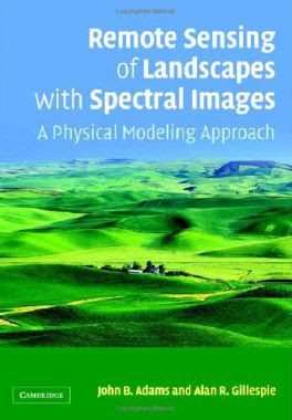
Remote Sensing of Landscapes with Spectral Images- A Physical Modeling Approach
Remote Sensing of Landscapes with Spectral Images
Spectral images, especially those from satellites such as Landsat, are used worldwide for many purposes, ranging from monitoring environmental changes and evaluating natural resources to military operations. In a significant departure from standard remote-sensing texts, this book describes
how to process and interpret spectral images using physical models to bridge the gap between the engineering and theoretical sides of remote sensing and the world that we encounter when we put on our boots and venture outdoors.
Monday, 15 April 2019
Geographic Information Systems (GIS) for Disaster Management
Preface of the Book
This book was primarily written for disaster management students interested in learning
about the many facets of Geographic Information Systems (GIS) for disaster management.
The unfortunate reality is that disasters will continue to proliferate in size, scope, and intensity. Future disasters will affect more people in diverse geographical contexts. Given that disasters are fundamentally spatial in nature, GIS plays a critical role in disaster management. However, there is an educational challenge and workforce need for well-educated practitioners and specialists who have a comprehensive, interdisciplinary understanding of the conceptual, technological, analytical, and representational capacities of GIS, as well as the policy and practice of disaster management. My hope is that this book can meet these challenges, even if partially.
The unfortunate reality is that disasters will continue to proliferate in size, scope, and intensity. Future disasters will affect more people in diverse geographical contexts. Given that disasters are fundamentally spatial in nature, GIS plays a critical role in disaster management. However, there is an educational challenge and workforce need for well-educated practitioners and specialists who have a comprehensive, interdisciplinary understanding of the conceptual, technological, analytical, and representational capacities of GIS, as well as the policy and practice of disaster management. My hope is that this book can meet these challenges, even if partially.
Sunday, 14 April 2019
GIS TECHNOLOGY APPLICATIONS IN ENVIRONMENTAL AND EARTH SCIENCES
Contents
1. General Overview of GIS .............................................................................1
What Is GIS? .....................................................................................................1
GIS Data .............................................................................................................2
Freeware/Shareware Metadata Tools ......................................................4
Commercial Metadata Tools ......................................................................5
Coordinate Systems and Projections .......................................................... 10
Spatial Data and Metadata Standards and Relevant Guidelines ............ 18
GIS History ..................................................................................................... 18
Major GIS Software Products .......................................................................27
Major Open-Source GIS Software Products ..........................................27
Major Commercial GIS Software Vendors and Products ....................45
GIS Technology Widely Used in Environmental and Earth Sciences ....47
2. Collecting Field Data More Ef ciently with GIS and GPS
Technologies .................................................................................................. 57
Monday, 8 April 2019
Advances in Environmental Remote Sensing Sensors, Algorithms, and Applications
Synopsis of the Book
This book is divided into four sections. Section I deals with various sensors, systems, or sensing using different regions of wavelengths. Section II exemplifies recent advances in algorithms and techniques, specifically in image preprocessing and thematic information extraction. Section III focuses on remote sensing of vegetation and related features of the Earth’s surface. Finally, Section IV examines developments in the remote sensing of air, water, and other terrestrial features.
GIS Fundamentals A First Text on Geographic Information Systems Fifth Edition
Contents of the Book
Chapter 1: An Introduction to GIS ................................ ........................1
Introduction......................................................................................1
What Is a GIS? .............................................................................................1
GIS: A Ubiquitous Tool................................................................................2
Why Do We Need GIS? ...............................................................................3
GIS in Action ...............................................................................................8
GIS Components ............................................................................15
Hardware for GIS.......................................................................................15
GIS Software..............................................................................................16
Open Geospatial Consortium.....................................................................16
ArcGIS .......................................................................................................17
QGIS ..........................................................................................................17
GeoMedia...................................................................................................17
MapInfo......................................................................................................18
Idrisi ...........................................................................................................18
Manifold.....................................................................................................19
Maptitude ...................................................................................................19
AUTOCAD MAP 3D.................................................................................19
GRASS.......................................................................................................19
MicroImages ..............................................................................................20
ERDAS.......................................................................................................20
Bentley Map...............................................................................................20
Smallworld .................................................................................................21
GIS in Organizations......................................................................22
Summary....................................................................................................23
The Structure of This Book .......................................................................23
Thursday, 4 April 2019
QGIS and Applications in Agriculture and Forest
Volume 2
Edited by
Nicolas Baghdadi
Clément Mallet
Mehrez Zribi
Introduction
Agriculture and forestry are fields strongly involved in the use of spatial data,
which are essential for monitoring and restoring the spatial and temporal variability
of surface states. The latter are key parameters in the understanding and modeling of
different plant and soil processes, and in the management of agricultural or forest
resources. A very good knowledge of these environments is therefore fundamental
both from an economic and ecological point of view. Remote sensing, thanks to the
great diversity of spatial (from precision agriculture to global crop monitoring),
spectral (active and passive sensors) and temporal (from rapid mapping to annual
crop monitoring) resolutions, has become an inevitable support to address these
issues. In this context, the use of Geographic Information System (GIS) tools has
long been present in accompanying the exploitation of spatial imagery.
Wednesday, 3 April 2019
REMOTE SENSING THE IMAGE CHAIN APPROACH
Author(s): John R. Schott
Publisher: Oxford University Press, USA, Year: 2007
ISBN: 978-0-19-517817-3
Table of contents :
CONTENTS......Page 12
1.1 WHAT IS REMOTE SENSING (AS FAR AS WE'RE CONCERNED)?......Page 20
1.2 WHY REMOTE SENSING?......Page 21
1.3 WHAT KINDS OF REMOTE SENSING?......Page 24
1.4 THE IMAGE CHAIN APPROACH......Page 36
1.5 REFERENCES......Page 40
Subscribe to:
Comments (Atom)
Labels of Contents
Applied Geomorphology
(3)
Article
(12)
Atmosphere
(1)
Book
(124)
Cartography
(2)
Civil Engineering
(1)
Data Analysis
(1)
Data Mining
(2)
Dictionary of Earth Science
(1)
Disaster Management Book
(5)
Engineering Geology
(8)
Environment
(7)
Folds
(1)
GIS
(75)
GRASS GIS
(3)
Geoinformatics
(1)
Geology
(31)
Geomorphology
(3)
Global Mapper 19
(1)
Global Mapper 20
(1)
Golden Software Surfer 13. Video
(1)
Ground Water Geology
(3)
Hydrology
(17)
Image Interpretation
(9)
Landslide
(3)
MATLAB
(2)
MODFLOW
(1)
Machine Learning
(1)
Mapping
(10)
Microsoft Excel Tutorial
(1)
Mineralogy
(2)
Modeling
(8)
PCI GEOMATICA 2016
(1)
PDF eBook
(31)
Petrology
(2)
Processing
(4)
QGIS Training
(15)
R
(1)
Remote sensing
(64)
Research Methodology
(1)
Rockwork 16
(2)
SAGA GIS
(1)
SAS Planet
(1)
Sedimentology
(3)
Soil
(6)
Song
(1)
Starter 5
(1)
Suitability Analysis using Model Builder ArcGIS 10
(1)
Technical Report
(3)
Training Manual
(20)
Tutorial
(21)
Video
(13)
Water Resources
(14)
arcgis for local government
(1)
arcgis online web app
(1)
coastal Geology
(1)
esri arcmap
(1)
esri business analyst
(1)
esri data
(1)
esri earth
(1)
esri local government
(1)
esri platform
(1)
esri software
(1)
esri tools
(1)
ezri gis
(1)
geonet esri
(1)
maximo gis
(1)
pdf
(140)
software
(12)
structural Geology
(7)
web GIS
(2)


