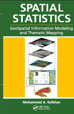
There is a need for such a book that can be used by people of different backgrounds and without advanced knowledge of geospatial information sciences such as remote sensing and geographic information systems (GIS), and of quantitative methods including biometry, statistics, sampling methods and design, and geostatistics.
This book will attempt to review the types and applications of these geospatial information data (e.g., remote sensing, GIS, and global positioning systems [GPS]) as well as their integration into landscape scale geospatial statistical models and thematic mapping natural resources, and ecological and environmental applications.
This book will attempt to review the types and applications of these geospatial information data (e.g., remote sensing, GIS, and global positioning systems [GPS]) as well as their integration into landscape scale geospatial statistical models and thematic mapping natural resources, and ecological and environmental applications.
The book has different focuses and reference citations. Following is a general description of the basic content related to each chapter to accomplish the goal of this book.
Principles and Applications
•
Chapter 1—Geospatial information sciences and technology in an
easy-to-follow format to integrate with geospatial modeling and
mapping applications.
• Chapter 2—Collection of data in terms of types, representation, and sources of errors; sampling methods and applications; probability sampling and nonrandom sampling; sampling designs and double sampling and mapping accuracy; plot design and criteria; characteristics of different plot shapes; and plot size.
• Chapter 3—Spatial pattern and correlation statistics, scale and spatial pattern, spatial sampling, errors in spatial analysis, spatial variability and method of predication, spatial pattern, linear correlation andspatial correlation statistics (Moran’s I, Geary’s C, cross-correlation statistics (bi-Moran’s I), and inverse distance weighting.
• Chapter 4—Geospatial analysis and modeling, thematic mapping, stepwise regression, ordinary least squares (OLS), variogram, kriging, and spatial autoregression, binary classification trees, cokriging, geospatial models for presence and absence data.
• Chapter 5—Topics related to the R Statistical Package are introduced. These topics cover the functions of the software, how to install it on a computer, working on statistical analysis with examples, working on case study, and steps to develop a geospatial statistical model (trend surface analysis) and thematic maps.
• Chapter 6—Integration of geospatial modeling and mapping applications using laboratory exercises. Topics relate to linking field data, integration using remotely sensed data, GIS, and analysis using geospatial modeling and mapping approaches.
Download Link


No comments:
Post a Comment