Georsgis Blog

↑ Grab this Headline Animator

Thursday, 31 January 2019

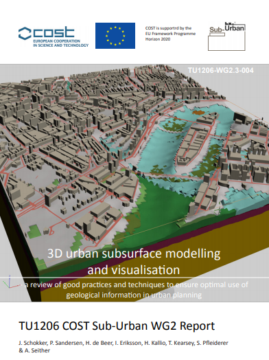
3D urban subsurface modelling and visualization

 A review of good practices and techniques to ensure optimal use of geological information in urban planning

TU1206 COST Sub-Urban WG2 Report

Authors: Jeroen Schokker (TNO), Peter Sandersen (GEUS), Hans de Beer (NGU), Ingelöv Eriksson (Oslo City), Hillka Kallio (GTK), Tim Kearsey (BGS), Sebastian Pfleiderer (GBA) & Anna Seither (NGU)


Summary
 This report is the result of COST Action TU1206 Working Group 2, Work package 2.3, and focusses on 3D urban subsurface modelling and visualization. The major aims of this report are: 1) evaluating current techniques and identify good practices / best efforts in 3D geological modelling and visualization of the urban subsurface, based on case studies, and 2) co-developing (subsurface specialists & model users) requirements for optimal use of 3D geological modelling information in specific planning and policy contexts.

Sunday, 27 January 2019

Training Module: Geoinformatics Applications in Disaster Management


Preface

Geo-information data and tools like Remote Sensing (RS), Geographic Information Systems (GIS) and Global Positioning Systems (GPS) have increasingly been used world over in pre, during and post disaster phases for generating updated maps, integrating information, visualizing scenarios and identifying and planning effective solutions. 


As part of capacity-building and training activities on disaster management, NIDM has been implementing various training programmes at national and state levels for technical working group members, disaster managers and community representatives. Training programmme on Geoinformatics in Disaster Management has been offered by the institute since 2005.


GRASS Reference Manual Raster Commands


GRASS Introduction 

GRASS (Geographic Resources Analysis Support System) is a raster based GIS, vector GIS, image processing system, and graphics production system. GRASS contains over 200 programs and tools to render maps and images on monitor and paper; manipulate raster, vector, and sites data; process multi spectral image data; and create, manage, and store spatial data. GRASS uses both an intuitive windows interface as well as command line syntax for ease of operations. GRASS can interface with commercial printers, plotters, digitizers, and databases to develop new data as well as manage existing data. GRASS is ideal for use in engineering and land planning applications. Like other GIS packages, GRASS can display and manipulate vector data for roads, streams, boundaries, and other features. GRASS can also be used to keep maps updated with its integral digitizing functions. Another feature of GRASS is its ability to use raster, or cell, data.

Advancing Culture of Living with Landslides -Volume 1


ISDR-ICL Sendai Partnerships 2015–2025
Kyoji Sassa • Matjaž Mikoš Yueping Yin, Editors

Foreword

Landslides are a serious geological hazard. Among the host of natural triggers are intense rainfall, flooding, earthquakes or volcanic eruption, and coastal erosion caused by storms that are all too often tied to the El Niño phenomenon. Human triggers including deforestation, irrigation or pipe leakage, and mining spoil piles, or stream and ocean current alteration can also spark landslides. Landslides occur worldwide but certain regions are particularly susceptible. The UN’s Food and Agriculture Organization underlines that steep terrain, vulnerable soils, heavy rainfall, and earthquake activity make large parts of Asia highly susceptible to landslides. Other hotspots include Central, South, and Northwestern America.

Friday, 25 January 2019

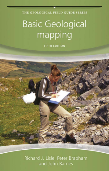
Book: Basic Geological Mapping-The Geological Field Guide Series,Fifth Edition

Basic Geological Mapping FIFTH EDITION
by Richard J. Lisle School of Earth and Ocean Sciences, Cardiff University Peter J. Brabham ,School of Earth and Ocean Sciences, Cardiff University and John W. Barnes 

Basic Geological Mapping

Content of the Book

Introduction 
1 1.1 Outline and Approach..............1
1 1.2 Safety ....................................2
2 1.3 Field Behavior.........................3
4 1.4 A Few Words of Comfort................................................... .............................5

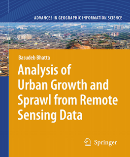
Book-Analysis of Urban Growth and Sprawl from Remote Sensing Data


Analysis of Urban Growth and Sprawl from Remote Sensing Data

Preface

Urban growth and sprawl is a pertinent topic for analysis and assessment towards the sustainable development of a city. Environmental impacts of urban growth and extent of urban problems have been growing in complexity and relevance, generating strong imbalances between the city and its hinterland.


The need to address this complexity in assessing and monitoring the urban planning and management processes and practices is strongly felt in the recent years.


Determining the rate of urban growth and urban spatial configuration, from remote sensing data, is a prevalent approach in contemporary urban geographic studies. Maps of growth and a classified urban structure derived from remotely sensed data can assist planners to visualize the trajectories of their cities, their underlying systems, functions, and structures.

There are currently a number of applications of analytical methods and models available to cities by using the remote sensing data and geographic information system (GIS) techniques, in specific—for mapping, monitoring, measuring, analyzing, and modelling.


Download Link


Thursday, 24 January 2019

Book:Soil and Environmental Analysis Physical Methods, Second Edition ,Revised and Expanded

Soil and Environmental Analysis- physical Methods, Second Edition

Soil and Environmental Analysis
Book Description
Content
  1. Soil Water Content ............................................1
  2. Metric Potential ................................................65
  3. Water Release Characteristic.............................95
  4.  Hydraulic Conductivity of Saturated Soils .....141
  5. Unsaturated Hydraulic Conductivity ...............183 
  6.  Infiltration .......................................................239
  7. Particle Size Analysis ......................................281
  8. Bulk Density ....................................................315
  9. Liquid and Plastic Limits .................................349
  10. Penetrometer Techniques in Relation to Soil 
  11. Compaction and Root Growth... .....................377
  12. Tensile Strength and Friability ........................405
  13.  Root Growth: Methods of Measurement......... 435 
  14.  Gas Movement and Air-Filled Porosity .........499
  15.  Soil Temperature Regime ..............................539
  16.  Soil Profile Description and Evaluation ........595

Download Link


Wednesday, 23 January 2019

Book: Open Source GIS-A GRASS GIS Aproach, 3rd edition


Image may contain: text
Contents
  1. Open Source software and GIS . . . . . . . . . . . . . . . . . . . . . . . . . . . . 1
  2. GIS concepts . . . . . . . . . . . . . . . . . . . . . . . . . . . . . . . . . . . . . . . . . . 7

QGIS Tutorial for Agrometeorological Practice

QGIS Tutorial for Agrometeorological Practice

The International Workshop on Agromet and GIS Applications for Agricultural Decision Making 


Date : December 5(Mon)~9(Fri), 2016 
Place : MSTAY Hotel JEJU 

Tuesday, 22 January 2019

Book: Remote Sensing for Geoscientist


Remote Sensing for Geo-scientist


  Download Link
http://bit.ly/2EfOQ5P

Monday, 21 January 2019

Free Download QGIS Training Manual

This training manual is intended to provide all the materials needed to run a 5 day course on QGIS, PostgreSQL and PostGIS. The course is structured with content to suit novice, intermediate and advanced users alike and has many exercises complete with annotated answers throughout the text.


Download Link


Book:Remote Sensing Geology by Ravi P. Gupta


There has been phenomenal growth in the field of remote sensing over the last two to three decades. It has been applied in the fields of geology, mineral exploration, forestry, agriculture, hydrology, soils, land use etc. - that is, in all pursuits of sciences dealing with the features, processes, and phenomena operating at the Earth's surface.


The status of geological remote sensing has rapidly advanced and the scientific literature is scattered. The aim of the present book is to systematically discuss the specific requirements of geological remote sensing, to summarize the techniques of remote sensing data collection and interpretation, and to integrate the technique into geo-exploration.


Remote Sensing Geology

The main conceptual features of the book are:
- To combine various aspects of geological remote sensing, ranging from the laboratory spectra of minerals and rocks to aerial and space-borne remote sensing.
- To integrate photo-geology into remote sensing.
- To promote remote sensing as a tool in integrated geo-exploration.
- To elucidate the wide-spectrum geoscientific applications of remote sensing,ranging from meso to global scale.
The book has been written to satisfy the needs of mainly graduate students and
active research workers interested in applied Earth sciences. It is primarily concept
oriented rather than system or module oriented.
The organization of the book is detailed in Chapter 1 (Table 1.1). The book has

three chief segments: (1) techniques, sensors and interpretation of data in the opti-
cal region; (2) techniques, sensors and interpretation of data in the microwave re-
gion; and (3) data processing, integration and applications.


Book: Soil Mechanics Fundamental


http://dapalan.com/Nu4U

Book: Image Interpretation in Geology

Book: Image Interpretation in Geology

Download Link

Exercises Open Source Software for Preprocessing GIS Data for Hydrological Models


Preface 
A Geographic Information System (GIS) can be a useful tool for preparing the input of models and tools. Furthermore, in this era of Open Data ample open access data is available that can easily be retrieved from the internet and integrated in open source desktop GIS software, such as QGIS. These exercises will guide you through different steps that are needed to preprocess data to be used in models and tools. In the first exercise you will learn how to register a scanned topographic map and use it as a backdrop for digitizing vector data. 

In the second exercise you will learn how to import data from spreadsheets into a GIS and to use it to join tables, manipulate the attribute table and interpolating the data to a continuous raster layer. In the third exercise you will download open access data from Open Street Map and use it for further analysis and conversion. The geodatabase will also be introduced in this exercise. In the fourth exercise you will use map algebra for spatial planning. 

Finally, you will learn how to delineate catchments and streams form digital elevation models and to present them in maps or in an interactive web page. The exercises have been developed for different MSc programmes at IHE Delft and tailor made training in Uganda, financed by the Vitens Evides International (VEI) fund. 

Learning objectives 
After following this step-by-step tutorial you will be able to: 
 Use QGIS in its main functionalities, also in conjunction with plugins 
Digitize features from a scanned map or satellite image 
Import tabular data in a GIS 
Do simple vector analysis 
Interpolate point data 
Convert vector and raster data 
Reproject vector and raster data 
Use map algebra 
Use online data 
Perform catchment and stream delineation

Software requirements 
During the next exercises we will make use of the following software: 
QGIS ver 2.18.11 (Las Palmas) or higher, 
Google Earth, 
Firefox Mozilla 
MS Excel or OpenOffice Calc

Preparation 
The exercises have been tested for QGIS 2.18.11. 
2) Install QGIS 
3) Install the exercise data from http://ocw.unesco-ihe.org

Download Link


Download Rockwork 2016


Download Rockwork 2016


Download link


Book:Making Strategies in Spatial Planning


Knowledge and Values ,Urban and Landscape Perspectives
Maria Cerreta · Grazia Concilio · Valeria Monno Editors


Preface of the Book
The idea of this book originated in the international School in Evaluation for Planning ‘Small-medium-sized Cities: perspectives of Strategic Planning’, held in Campi Salentina (Southern Italy) in October 2006 and organised by the book’s editors. The school was conceived as an occasion to explore synergies and complementarities between evaluation and planning within the framework of strategic planning.
At the beginning of this century, making strategic spatial plans (Healey, Khakee, Motte, & Needham, 1997) was foremost on planning agendas.

Sunday, 20 January 2019

Book: Disaster Management Hand Book


Book: Disaster Management Hand Book
Download Link

http://bit.ly/2QQYw9N

Book: Remote Sensing and Image Interpretation, 7th edition


Book: Remote Sensing and Image Interpretation, 7th edition


PREFACE OF THE BOOK

This book is designed to be primarily used in two ways: as a textbook in introductory courses in remote sensing and image interpretation and as a reference for the burgeoning number of practitioners who use geospatial information and analysis in their work. Rapid advances in computational power and sensor design are
allowing remote sensing and its kindred technologies, such as geographic information systems (GIS) and the Global Positioning System (GPS), to play an increasingly important role in science, engineering, resource management, commerce, and other fields of human endeavor.

Image Processing and GIS for Remote Sensing Techniques and applications

Jian Guo Liu and Philippa J. Mason 
Department of Earth Science and Engineering, Imperial College London Second Edition


Overview of the book
Remote sensing is a mechanism for collecting raster data or images, and remotely sensed images represent an objective record of the spectrum relating to the earth surface materials. Information extraction from physical properties and chemical composition of the those images is, on the other hand, an entirely foci will derive very different thematic information subjective process. People with differing application from the same source image.


Image processing thus For more in‐depth analysis, the images need to be becomes a vital tool for the extraction of thematic and/or quantitative information from raw image data. analysed in conjunction with other complementary truth’ data, logistical and infrastructure information; data, such as existing thematic maps of topography, geomorphology, geology and landuse, or with geochemical and geophysical survey data, or ‘ground and so here comes GIS, a highly sophisticated tool for to be covered in one book. As illustrated in Fig. 0.1, our the management, display and analysis of all kinds of spatially referenced information. Remote sensing, image processing and GIS are all extremely broad subjects in their own right; far too broad.


The application cases are biased toward the earth sciences but the image processing and GIS techniques are book is aimed at the overlap between the three disciplines, providing an overview of essential techniques and a selection of case studies in a variety of application areas, emphasizing the close relationship between them.generic and independent of any software, and therefore and with conceptual illustrations. For image processing transferable skills suited to all applications.The book has been written with university students and lecturers in mind as a principal textbook. For students’ needs in particular, we have tried to convey knowledge in simple words, with clear explanations much mathematical detail. The result is intended to be and GIS, mathematics is unavoidable, but we understand that this may be off‐putting for some. To minimize such effects, we try to emphasize the concepts, explaining in common sense terms rather than in too a comprehensive yet ‘easy learning’ solution to a fairly challenging topic. 


There are sections providing extended coverage of some necessary mathematics and advanced materials for use by course tutors and lecturers; these sections will be marked as such. Hence the book is written for both students and teachers. With many author‐developed techniques and recent research case studies, it is also an excellent reference book for higher level readers including researchers and professionals in remote sensing application sectors. In this book, we have presented a unique combination of tools, techniques and applications that we hope will be of use to the full breadth of geoscientific and remote sensing communities. 


The book begins with the fundamentals of the core image processing tools used in remote sensing and GIS with adequate mathematical details in Part I, then it becomes slightly more applied and less mathematical in Part II to cover the wide scope of GIS where many of those core image processing tools are used in different contexts. Part III contains the entirely applied part of the book, where we describe a selection of cases where image processing and GIS have been used, by the authors, in teaching, research and industrial projects in which there is a dominant remote sensing component. Since the publication of the first edition in 2009, we have been pleasantly delighted and encouraged by the interest in this book, and comments from students and colleagues alike have stimulated us to produce this second edition. 

In making the explanations of the book generic and not tied to any particular software, we attempted to ‘future‐proof’ its content in the first edition. Inevitably, however, there are many small things that have needed to be updated in this second edition. We have implemented minor updates to all the main chapters in Parts I and II. A completely new chapter on sub‐pixel technology and image phase correlation has been added in Part I (Chapter 11), which is based on new and ongoing research in this area. Part  III has been considerably enhanced with more recent case studies to include new data and/or other new complementary research where relevant. We also take this opportunity to acknowledge the many data sources that we have made use of in this book. These include NASA’s 40‐year Landsat archive (without which much of our daily work would be impossible), ESA radar image archive (ERS and Envisat), Aster GDEM and SRTM global elevation data, ESRI’s online knowledge base, and the NERC (Natural Environment Research Council, UK) airborne campaign (Airborne Thematic Mapper). Images are both the principal input and product of remote sensing and GIS, and they are meant to be visualised! The e‐version of the book therefore now contains hyperlinks to high resolution digital versions of the images and illustrations, allowing the reader to examine the details at pixel level and to appreciate the effects of particular processing techniques such as filtering, image fusion, and so forth.


Download Link
Book:Image Processing and GIS for Remote Sensing Techniques and applications


Download- Applied Sedimentology, 2nd Edition by Richard C. Shelley


Book Description:
Applied Sedimentology is divided into three parts: Rock to Sediment, Sediment Sedimented, and Sediment to Rock, reflecting the holistic nature of the sedimentary cycle. 


An introductory chapter outlines the field of sedimentology, relates it to the fundamental sciences, and discusses its applications. Part I, Rock to Sediment, consists of two chapters. 


Chapter 2 outlines weathering, showing not only how weathering gives rise to the terrigenous sediments, but also how it mobilizes and concentrates diverse residual ore deposits. 


Chapter 3, Particles, Pores, and Permeability, describes the texture of sediments and shows how these are related to porosity and permeability. ix X PREFACE Part II, Sediment Sedimented, takes the story a stage further.


Thursday, 17 January 2019

Download Open access Remote Sensing eBook

Open access eBook: UAV or Drones for Remote Sensing Applications (Volume 1 and 2)

Edited by Felipe Gonzalez Toro and Antonios Tsourdos
 www.mdpi.com/journal/sensors,  Printed Edition of the Special Issue Published in Sensors,Published: November 2018

Download link
Volume1


 UAV or Drones for Remote Sensing Applications 

Edited by Felipe Gonzalez Toro and Antonios Tsourdos 
www.mdpi.com/journal/sensors  Printed Edition of the Special Issue Published in Sensors,Published: November 2018

Download link
Volume 2


Book: Environmental Science by Dr. Y. K. Singh

Book Description: Content Summary

  • Environmental Science: Definition, Scope and Importance
  • Environmental Science: Natural Resources
  • Environmental Science: Ecosystem
  •  Environmental Science: Biodiversity and Conservation
  • Environmental Science: Pollution and its Factors
  • Environmental Science: Social Issues
  • Environmental Science: Human Population and Environment
  • Environmental Science: Field Trip
  • Environmental Science: Modern Methods
  •  Environmental Science: Modern Library
  • Environmental Science: Modern and Effective Teacher
  • Glossary
  • Reference
  • Download link 👇👇👇

Image may contain: cloud, sky, tree, outdoor, text and nature


Contact us

Name

Email *

Message *

Follow us on Facebook and YouTube