Georsgis Blog

↑ Grab this Headline Animator

Showing posts with label Tutorial. Show all posts

Tuesday, 10 March 2020

GIS Tutorial Basic Work Book 1


GIS Tutorial 1: Basic Workbook is the direct result of the authors' experiences teaching GIS to high school students in a summer program at Carnegie Mellon University, undergraduate and graduate students in several departments and disciplines at Carnegie Mellon University, as well as working professionals. 


GIS Tutorial 1 is a hands-on workbook with step-by-step exercises that take the reader from the basics of using ArcGlS Desktop interfaces through performing advanced spatial analyses.
Instructors can use this book for the lab portion of a GIS course, or individuals can use it for self-study. You can learn a lot about GIS concepts and principles by "doing" and we provide many short notes on a "just-in-time" basis to help this kind of learning. 

Monday, 29 July 2019

Download and Install PCI GEOMATICA v 2016

Download and Install PCI GEOMATICA v 2016


Download and Install Global Mapper v 20 (64 bit) Free


Download and Install Golden Software Surfer v 13


Download and Install Golden Software Surfer v 13
https://youtu.be/PnetIthpdn0

Wednesday, 20 March 2019

Advances in Remote Sensing and GIS applications in Forest Fire Management From local to global assessments


Preface
The importance of wildfires as a natural or a human-induced phenomenon has gained importance at regional and global levels in the last years. Improved remote sensing and computational capabilities enable the fast processing of large image datasets in real time. As a result, remote sensing and geographic information systems are today, more than ever before, common tools for fire monitoring at local, regional and global levels. However, the gap between research and operational use of remote sensing and GIS still exists.

Wednesday, 13 March 2019

SAGA GIS Manual-Satellite Image Analysis and Terrain Modelling


This training manual has been developed with support from the Australian government via funding provided through their Artisanal and Small-scale Mining for Development project being implemented by Charles Darwin University. This project has been run and the material for this manual developed in collaboration between three universities in Eastern Indonesia and Australia 1) Charles Darwin University (Darwin), 2) UNDANA University (Kupang) and 3) Haluoleo University (Kendari – South East Sulawesi).

Monday, 11 March 2019

Remote Sensing in an ArcMap Environment

Tutorial eBook Remote Sensing in an ArcMap Environment


Introduction to this Manual

This manual, and associated videos, introduce users of ArcGIS to image analysis capabilities, now available in ESRI’s ArcGIS 10.X versions. The user does not need prior knowledge of ArcGIS as we provide a review ArcMap and ArcCatalog basics, although prior knowledge of ArcGIS is helpful.

Monday, 4 March 2019

GRASS GIS Tutorial Vector and Imagery Commands

GRASS Introduction 

GRASS (Geographic Resources Analysis Support System) is a raster based GIS, vector GIS, image processing system, and graphics production system.


GRASS Ref. Manual
GRASS contains over 200 programs and tools
to render maps and images on monitor and paper; manipulate raster, vector, and sites data; process multispectral image data; and create, manage, and store spatial data. GRASS uses both an intuitive windows interface as well as command line syntax for ease of operations. GRASS can interface with commercial printers, plotters, digitizers, and databases to develop new data as well as manage existing data. GRASS is ideal for use in engineering and land planning applications.

Semi-Automatic Classification Plugin for Qgis

Version 5.3.6.1


SCP

Developed by Luca Congedo, the Semi-Automatic Classification Plugin (SCP) is a free open source plugin for QGIS that allows for the semi-automatic classification (also known as supervised classification) of remote sensing images. 

SCP


It provides several tools for the download of free images, the preprocessing, the postprocessing, and the raster calculation (please see What can I do with the SCP ? (page 257)). The overall objective of SCP is to provide a set of intertwined tools for raster processing in order to make an automatic workflow and ease the land cover classification, which could be performed also by people whose main field is not remote sensing. 

Sunday, 3 March 2019

Mastering ArcGIS

Mastering the Concepts 

GIS Concepts Representing real-world objects on maps To work with maps on a computer requires developing methods to store different types of map data and the information associated with them. Map data fall into two categories: discrete and continuous. 
Mastering ArcGIS 


Discrete data are objects in the real world with specific locations or boundaries, such as cities, roads, or soils units. Continuous data represent a quantity that is measured and recorded everywhere over a surface, such as temperature or elevation.

Wednesday, 27 February 2019

Administering ArcGIS for Server

Installing and configuring ArcGIS for Server to publish, optimize, and secure GIS services

Foreword GIS is a mature industry, with its roots in the late 60s in forestry and county polygon maintenance through vector topology (others such as GRASS and IDRISI concentrated on the raster domain). Storing location and attribute information has been a challenge, not only since the early days of severely limited computing power and storage space, but even today in the management of ever-growing spatial and tabular repositories. 
Administering ArcGIS for Server
This has been handled in several ways: two tenors being Esri Arc/Info separating the spatial and the tabular repositories, and Oracle Spatial embedding them in database tables. Esri evolved from the desktop to the server by offering SDE, a layer between its data and RDBMS that effectively spatialises database tables. After the arrival of the Internet, further web services have been devised by commercial and open source technologies alike, but that is a subject in its own right? And while RDBMS scales hardware such as Oracle Exadata, as data expands to petabytes in real time, a whole other arena such as Amazon services or SAP in-memory addresses Big Data. But what about big geo data? ArcGIS for Server is the third generation that adds a host of management, integrity, and performance tools designed to help implement scalable enterprise GIS. Hussein is a geo enthusiast, whose chief concern is to make the "Gen 3" mid-section above amenable to geo experts and project engineers alike. As a practitioner in the field, he brings a deft touch to the ins-and-outs of this powerful yet complex offering. Esri being the de facto server geo standard, this book will benefit a wide array of infrastructure administrators and application engineers. Yet Hussein's clear prose explains it well enough; his first principles will allow his audience to apply their lessons learned to other platforms, and therein lies the "sweet spot": ArcGIS for Server offers interoperability to many other server and service platforms. This book will thus be a great learning guide to help you understand the interconnectivity of data and applications. The biggest takeaway may be that readers will discover the "Internet of things" as a real-world paradigm, rather than just concepts "in the clouds" or "in the cloud". As an IT and poet friend once said: "Ladies and gentlemen… start your servers… and let the geo begin!"

Preface If you are at a library and you grabbed this book, chances are that you have heard about ArcGIS for Server in a meeting and you want to know what this product is and what it is capable of. You might have picked up this book because you were explicitly asked by your manager to investigate the capability of this bleedingedge technology and report with tangible results. Or maybe you are a system administrator who is in the middle of implementing ArcGIS for Server as your backbone architecture. Whether you are a curious blogger, a business developer, or a technical system analyst, I can guarantee that this book won't disappoint you. Administering ArcGIS for Server was designed for all levels. You might get a satisfying definition of the product and its components, with comprehensive and straightforward illustrations, by reading the first chapter of this book. If you want to just test ArcGIS for Server, you can get it up and running in testing track—a quick, simple, and efficient method for installation—and do the exercises in most of the chapters. If you are planning to set up ArcGIS for Server on your production environment, you can fully read all of the chapters and appendices and explore the advanced security preferences and performance tips to make your setup run optimally.

What this book covers 
Chapter 1, Best Practices for Installing ArcGIS for Server, introduces the product and illustrates its architecture and components. It then takes you through three tracks for installing the product: the simple testing track, the advanced tech-savvy production track, and finally the last track, which will show you how to set up and configure ArcGIS for Server specifically as a virtualized environment. Chapter 2, Authoring Web Services, teaches you the concept behind a web service and different communication protocols. You will also learn how to author and publish GIS services so various clients can consume them.

Chapter 3, Consuming GIS Services, illustrates how to consume services that you learned to author and publish in the previous chapter. You will learn how to visualize, edit, and analyze services using different clients. Chapter 4, Planning and Designing GIS Services, is where you will analyze requirements and plan what services you want to have. You then will use the planning result to design the services you nominated with rich UML tools. You will also learn to design the underlying geodatabase, which is the source that feeds these services. Chapter 5, Optimizing GIS Services, shows you how to select the correct parameters and preferences that will make your ArcGIS for Server run at its optimal state. Optimization techniques such as pooling, process isolation, and caching can be applied to bring the most out of your ArcGIS for Server and make your services run much more efficiently and effectively. Chapter 6, Clustering and Load Balancing, introduces the concept of clustering, a new technique that allows you to group machines into a cluster. You can then assign services to run on each cluster based on machine power, memory, or even on networking factors. Chapter 7, Securing ArcGIS for Server, introduces different security mechanisms available on ArcGIS for Server. GIS-tier authentication, Web authentication, and HTTPS can be applied interchangeably, depending on the security level desired by your organization. Chapter 8, Server Logs, will teach you how to harvest the logs and reports generated by ArcGIS for Server and use them to monitor your system effectively. There are different levels of logs, ranging from abstract to detailed, and the level you configure for your setup will depend on how thoroughly you want to monitor your ArcGIS for Server. Fine and detailed logs come with a performance penalty. Appendix A, Selecting the Right Hardware, describes how to select the right hardware for your ArcGIS for Server environment by providing general rules of thumb. I have come up with formulas that you can use to calculate the number of cores and amount of memory required to serve your users. Appendix B, Server Architecture, will display the difference between the old and the new ArcGIS for Server architecture. You are going to learn how ArcGIS for Server has survived the 32-bit architecture locking trap and migrated to the more effective 64-bit architecture.

What you need for this book 
You need the following software for this book: • A Browser, preferably Google Chrome, which you can download from http://www.google.com/chrome. • Esri ArcGIS for Server 10.2 or 10.1, preferably 10.2, which you can download a trial of from http://www.esri.com/software/arcgis/trial or order from your local Esri distributor. • Esri ArcGIS for Desktop 10.2 or 10.1, preferably 10.2, which you can download a trial of from http://www.esri.com/software/arcgis/trial or order from your local Esri distributor. • Microsoft SQL Server Express 2012, which you can download for free from http://www.microsoft.com/en-us/download/details.aspx?id=29062. • Oracle VirtualBox, which you can download for free from https://www.virtualbox.org/.

Who this book is for
 Whether you are a GIS user, analyst, DBA, system administrator, or programmer with a basic knowledge of Esri GIS, this book is for you. Although the book is tailored to fit system administration and analyst requirements, users can find it equally useful. Each chapter segregates the advanced technical tips from the basic and required tasks. This makes it easier for users to perform only the necessary steps to run the software.

Download link

Exercise Workbook-Introduction to 3D Data Modeling with ArcGIS 3D Analyst and Google Earth


Introduction to 3D Data 
by K. Heather Kennedy


Preface Introduction to 3D Data teaches GIS specialists, analysts, and technicians how to use ESRI ’ s ArcGIS 3D Analyst to model and analyze three - dimensional geographical surfaces, create 3D data, and produce displays ranging from topographically realistic maps to 3D scenes and spherical earthlike views.

Tuesday, 19 February 2019

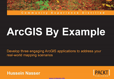
ArcGIS Tutorial E-book-ArcGIS By Example

ArcGIS by example
Preface of the book:
 Over the last two years, I have written three books on ArcGIS technology. Each book covers different topics and fields of this increasingly ubiquitous technology. 


Although I used examples and various real-life project approaches to explain the technology in all my books, this is the first book where the content evolves with the help of examples. I have been working with Esri ArcGIS since 2005 when ArcGIS 9.1 was released, so writing this title from a technological point of view was not difficult.
In fact, it was thrilling. The challenging part was to come up with three unique real life examples and to build them up as I wrote the book. Each example should target certain features of the technology and explain them along the way. These three examples are all from my own imagination and they are not linked to or correlate with any actual projects that I personally worked on or witnessed. You will not find any of these examples in Esri's help or on any online resource. All the code that is available in this book is written from scratch for this book that you are holding in your hands.

GIS Tutorial E book-PYTHON Scripting for ArcGIS

Preface 


The impetus for writing this book came from the lessons I’ve learned from using and teaching geographic information systems (GIS) for over 10 years at several different universities. One of these lessons is that “a little bit of code can go a long way.” Those of us who learned our first computer skills back in the days of MS-DOS became familiar with using a command prompt to carry out basic tasks.


Early versions of ArcGIS for Desktop Advanced (ArcInfo) software also relied heavily on a command line interface, in addition to the use of the ARC Macro Language (AML). 

Sunday, 17 February 2019

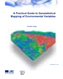
Training Manual-A Practical Guide to Geo-statistical Mapping of Environmental Variables

The guide consists of four chapters. The first chapter is an introductory chapter to the practice of geostatistical mapping and gives an overview of the spatial prediction techniques. The second chapter zooms into regression-kriging and its characteristics, advantages and limitations. 


A Practical Guide to Geostatistical Mapping of Environmental Variables


The third chapter is completely dedicated to installation and doing first steps in the software, and the last, fourth, chapter gives a step-by-step guide through analysis and generation of final layouts by using a digital soil mapping case study. After reading the first chapter, you should understand what the geostatistical mapping is; after reading the second chapter, you should know how to select the right spatial prediction technique for your application; after reading the third chapter, you should be able to install all packages used in the handbook and be aware of their capabilities; and after reading the fourth chapter, you should know how to run geostatistical mapping, prepare final layouts and interpret the results of analysis for your own case study. This guide evolved as a lecturing material that has been used for a 5-day training course called “Hands-on-geostatistics: Merging GIS and Spatial Statistics”. The objective of this course was to provide theoretical backgrounds and practical training on the use of hybrid geostatistical/GIS tools for various applications ranging from spatial prediction to sampling and error propagation. In addition, the leitmotive of the course was to provide practical training in command-based software packages such as R. We aimed at Master and PhD level students and post-doctoral researchers in various fields of environmental and geo-sciences interested in spatial prediction and analysis of environmental variables. We have run this course already twice: at the Facolta di Agraria in Naples (29.01-03.02.2007), and at JRC Ispra (03.06-07.06.2007). At both occasions, the interest exceeded our expectations.

Sunday, 10 February 2019

Introduction Geo-Information Science- practical manual

Introduction Geo-Information Science- practical manual .The practical manual contains eleven modules. After this introduction there are ten modules dealing with basic GIS topics using the software package ArcGIS 

Introduction Geo-Information Science-Practical Manual
and one module dealing with Remote Sensing topics using the software package Erdas Imagine. Each module is divided into sections that treat different aspects of one topic. Each section contains some background information followed by software instructions and one or more exercises to practice the theory and to test whether you understood the subject. By the end of this practical you will be able to use GIS and Remote Sensing software as tools to help you work on a practical case study. Although some theoretical background is given in each module, this manual is not meant to be a lecture textbook, so for explanations about GIS-concepts we refer to the lectures (PowerPoint presentations are available on the course website) and the lecture book and reader (see below). The practical must be regarded as an extension of the lectures in which GIS and Remote Sensing theory is clarified by means of exercises using the software packages ArcGIS and Erdas Imagine.  
Download link
http://bit.ly/2IdMrMC

Tuesday, 5 February 2019

Sunday, 3 February 2019

Free Download and Install Golden Software Strater V5 Crack

Contact us

Name

Email *

Message *

Follow us on Facebook and YouTube