Georsgis Blog

↑ Grab this Headline Animator

Showing posts with label PDF eBook. Show all posts

Tuesday, 14 December 2021

GEOTECHNICAL ENGINEERING pdf

 PURPOSE AND SCOPE OF THE BOOK 'GEOTECHNICAL ENGINEERING'

There are not many books that cover both soil mechanics and foundation engineering which a student can use for his paper on Geotechnical Engineering. This paper is studied compulsorily

and available books, whatever few are there, have not been found satisfactory. Students are compelled to refer to three or four books to meet their requirements. The author has been prompted by the lack of a good comprehensive textbook to write this present work. He has made a sincere effort, to sum up, his experience of thirty-three years of teaching in the present book. The notable features of the book are as follows:
Saturday, 11 September 2021

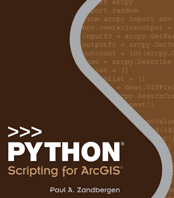
Python-Scripting-for-ArcGIS.pdf

 Preface of the Book

The impetus for writing this book came from the lessons I’ve learned from using and teaching geographic information systems (GIS) for over 10 years at several different universities. One of these lessons is that “a little bit of code can go a long way.” Those of us who learned our first computer skills back in the days of MS-DOS became familiar with using a command prompt to carry out basic tasks. Early versions of ArcGIS for Desktop Advanced (ArcInfo) software also relied heavily on a command line interface, in addition to the use of the ARC Macro Language (AML).

 
Python-Scripting-for-ArcGIS.pdf

Monday, 16 November 2020

Handbook of Applied Spatial Analysis Software Tools, Methods and Applications


 Preface

The Handbook is written for academics, researchers, practitioners and advanced graduate students. It has been designed to be read by those new or starting out in the field of spatial analysis as well as by those who are already familiar with the field.


The chapters have been written in such a way that readers who are new to the field will gain important overview and insight. At the same time, those readers who are already practitioners in the field will gain through the advanced and/or updated tools and new materials and state-of-the-art developments included.


Friday, 9 October 2020

Remote Sensing Image Fusion, pdf eBook


Preface of the Book


Nowadays, approximately four TB of image data are collected daily by instruments mounted on satellite platforms, not to mention the data produced by a myriad of specific campaigns carried out through airborne instruments. Very high-resolution (VHR) multispectral scanners, IKONOS, QuickBird, GeoEye,WorldView, Pl ́eiades, just to mention the most popular, and especially the related monospectral panchromatic instruments are responsible for a large part of the amount.

Thursday, 24 September 2020

Geospatial Tools for Urban Water Resources


Preface of the Book

Advances in the field of geospatial technologies have resulted in the growth in the application of such methods and techniques to a wider range of challenges and issues associated with urban water resources. The use of remote sensing, geographic information science (GIS), spatial analysis, global positioning systems (GPS),


digital mapping, online electronic data resources, and processing techniques are now common tools in addressing urban water quality, storm water, flooding, water supply issues, and overall management of water resources and watersheds in urban communities and urbanizing landscapes. In this volume, the authors address many of the complex concerns and impacts associated with human and natural changes


facing urban water resources through their use of a variety of geospatial techniques and tools. The aim of the volume is to present the reader a mix of examples of the evolving use of geospatial methods and applications now utilized in many urban areas to assist decision-makers, planners, and communities in making sound judgments as to how best manage their water resources for both human use and to minimize impacts to the natural environment. 

Sunday, 6 September 2020

Mastering ArcGIS Pro


A new text for a new GIS experience

Although the concepts of GIS have remained fairly constant over time, the software is continually

evolving. With the release of ArcGIS Pro, the latest software in the Esri GIS family, a new generation of GIS has arrived. ArcGIS Pro has a 64-bit, multithreaded architecture, uses ribbon-style menus, integrates 2D and 3D applications, and is closely tied to ArcGIS Online.

Sunday, 10 May 2020

Earth Materials- Introduction to Mineralogy and Petrology


Contents Description

Basic aspects of mineralogy must precede the coverage of petrology. This sequence is obvious from chapter headings. After a brief, general introduction in Chapter 1, minerals and rocks are broadly defined in Chapter 2. That is followed by three chapters that relate to various mineralogical aspects and concepts. 

Wednesday, 8 April 2020

Spatial Analysis in Epidemiology


Preface of the Book


This book aims to provide a practical introduction to spatial analysis, by focusing on application rather than theory, and by drawing on a wide range of examples from both human and animal health, including vector-borne and infectious diseases and non-infectious conditions. This book provide worked examples of the principal methodologies, using mainly the same disease data set throughout, which allows for direct comparison of the various techniques and helps to demonstrate their comparative strengths and weaknesses.


Wednesday, 1 April 2020

WETLAND AND WATER RESOURCE MODELING AND ASSESSMENT A Watershed Perspective


WETLAND  AND WATER RESOURCE MODELING  AND  ASSESSMENT A Watershed Perspective


Preface: Toward a Watershed Perspective


This is a book about the methods and geospatial techniques for modeling and assessing wetlands and water resources at the watershed scale.The theme of the book, wetland and water resource modeling and assessment, is an active field of research that constantly undergoes theoretical and technical innovations. This book emphasizes a watershed perspective in the modeling and assessment areas. 


Wednesday, 25 March 2020

INTRODUCTIONTO GEOGRAPHIC INFORMATION SYSTEMS


INTRODUCTIONTO GEOGRAPHIC INFORMATION SYSTEMS


by Kang-tsung Chang, 9th Edition

Preface of the Book


A geographic information system (GIS) is a computer system for storing, managing, analyzing, and displaying geospatial data. Since the 1970s GIS has been important for professionals in natural resource management, land use planning, natural hazards, transportation, health care, public services, market area analysis, and urban planning. It has also become a necessary tool for government agencies of all levels for routine operations. The more recent integration of GIS with the Internet, a global positioning system (GPS), wireless technology, and Web service has found applications in location-based services, Web mapping, in-vehicle navigation systems, collaborative Web mapping, and volunteered geographic information.

Thursday, 19 March 2020

Hillslope Hydrology and Stability


Landslides occur when hillslopes become mechanically unstable, because of meteorological and geologic processes, and pose a serious threat to human environments in their proximity. The mechanical balance within hillslopes is governed by two coupled physical processes: hydrologic or subsurface flow and stress. 

Wednesday, 11 March 2020

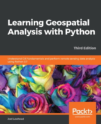
Learning Geospatial Analysis with Python


Learning Geospatial Analysis with Python: Understand GIS fundamentals and perform remote sensing data analysis using Python 3.7

This book is for Python developers, researchers, or analysts who want to perform geospatial modeling and GIS analysis with Python. Basic knowledge of digital mapping and analysis using Python or other scripting languages will be helpful.


Author(s): Joel Lawhead
Publisher: Packt Publishing, Year: 2019
ISBN: 1789959276, 978-1789959277


Sunday, 23 February 2020

eBook-Multiscale Hydrlogic Remote Sensing-Perspective and Applications


Multiscale Hydrlogic Remote Sensing-Perspective and Applications

Multiscale Hydrlogic Remote Sensing-Perspective and Applications

Contents

Preface ......................................................................................................................ix
About the Editors......................................................................................................xi
Contributors........................................................................................................... xiii

Chapter 1 Toward Multiscale Hydrologic Remote Sensing for Creating Integrated Hydrologic Observatories...................................................1
Ni-Bin Chang and Yang Hong


Part I Local-Scale Hydrological Remote Sensing

Thursday, 26 December 2019

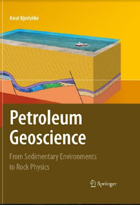
Petroleum Geoscience: From Sedimentary Environments to Rock Physics


Preface
Petroleum geology is not a well-defined academic subject. It includes many different aspects of the Earth sciences which are used in petroleum exploration and production. Nearly all types of insight can in some cases be useful in petroleum exploration,but there are some disciplines that are most relevant. 


Sunday, 15 December 2019

Drawing Geological Structures


PREFACE
Drawing is not one of my strengths. My firs attempts at representing rock structures from the fiel on paper ended in disaster, both with regard to the graphic quality as well as the information content of the drawings. It took a long time for me to be able to draw structures halfway precisely and increase their recognition value; to use perspective; to learn to draw symbolically; and to compose larger outcrop drawings and block diagrams.

Thermal Infrared Remote Sensing


Foreword
Temperature is one of the most important physical environmental variables monitored by Earth observing remote sensing systems. Be it land surface temperature, sea surface temperature, or air temperature, temperature ranges define the boundaries of habitats on our planet. Already thousands of years ago, temperature defined where we humans can settle and survive. Which plant resources are available? What wildlife is present? Which crops can be grown? 


Thursday, 28 November 2019

Groundwater Hydrology Engineering, Planning and Management


Preface: The demand for freshwater is increasing as the world’s population continues to grow and expects higher standards of living.

Monday, 4 November 2019

Data Mining Concepts and Techniques Third Edition


Preface 

The computerization of our society has substantially enhanced our capabilities for both generating and collecting data from diverse sources. A tremendous amount of data has flooded almost every aspect of our lives. This explosive growth in stored or transient data has generated an urgent need for new techniques and automated tools that can intelligently assist us in transforming the vast amounts of data into useful information and knowledge. 


This has led to the generation of a promising and flourishing frontier in computer science called data mining, and its various applications. Data mining, also popularly referred to as knowledge discovery from data (KDD), is the automated or convenient extraction of patterns representing knowledge implicitly stored or captured in large databases, data warehouses, the Web, other massive information repositories, or data streams. 


Wednesday, 23 October 2019

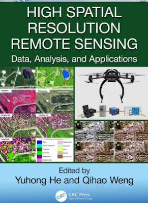
High Spatial Resolution Remote Sensing Data, Analysis, and Applications


High Spatial Resolution Remote Sensing Data, Analysis, and Applications


Preface

1 INTRODUCTION


High spatial resolution data provide a novel data source for addressing environmental questions with an unprecedented level of detail. These remote sensing data are a result of significant advances in image acquisition platforms and sensors, including satellite, manned aircraft, and unmanned aerial vehicle (UAV) platforms. Furthermore, the recent development of commercially operated satellite platforms with high spatial resolution sensors allows for the collection of a large amount of images at regular time intervals, with relatively large footprints (i.e., image swathes). For example, the WorldView series, with the WorldView-1 satellite launched on September 18, 2007, and WorldView-4 launched on November 11, 2016, are capable of resolving objects at 31 cm in the panchromatic band and at 1.24 m in 4 (or 8)-band multispectral over a 13.1-km-wide swath. 


Wednesday, 16 October 2019

ENVIRONMENTAL HYDROLOGY SECOND EDITION


BOOK ORGANIZATION

The purpose of this book is to provide a qualitative understanding of hydrologic processes and an introduction to methods for quantifying hydrologic parameters and processes. It has been prepared for use in introductory hydrology courses taught at universities to students of environmental science, natural resources, geology, geography, agricultural engineering, and environmental engineering.

Contact us

Name

Email *

Message *

Follow us on Facebook and YouTube