Georsgis Blog

↑ Grab this Headline Animator

Showing posts with label Training Manual. Show all posts

Thursday, 4 November 2021

ESA SNAP WORKBOOK

ESA SNAP WORKBOOK
by Astri Polska

----------

from EO4EP – Earth Observation for Eastern Partnership

earth observation for sustainable development

Download Link: MergedFile (eo4sd-eastern.eu)

----------

This book is helpful for the beginner learners for SNAP sentinel toolbox.

Contains 5 chapters: first chapter deals with the installation guides; second, third and third chapter deals with basic raster tools within the software, optical and radar data processing respectively; and the final chapter with the automation of the process.

The book has only 46 pages making it very handy, crispy and easy to follow making it less bulkier. Although the major explanations of each step is lacking and real cases are not so fully provided, this is the reason this book presents the necessary steps for the early learners as a handy book. Definitely download for the early learners, or for others to revise and view it once.

----------

Download Link: MergedFile (eo4sd-eastern.eu)


Tuesday, 10 March 2020

GIS Tutorial Basic Work Book 1


GIS Tutorial 1: Basic Workbook is the direct result of the authors' experiences teaching GIS to high school students in a summer program at Carnegie Mellon University, undergraduate and graduate students in several departments and disciplines at Carnegie Mellon University, as well as working professionals. 


GIS Tutorial 1 is a hands-on workbook with step-by-step exercises that take the reader from the basics of using ArcGlS Desktop interfaces through performing advanced spatial analyses.
Instructors can use this book for the lab portion of a GIS course, or individuals can use it for self-study. You can learn a lot about GIS concepts and principles by "doing" and we provide many short notes on a "just-in-time" basis to help this kind of learning. 

Monday, 10 June 2019

ArcGIS for Environmental and Water Issues


ArcGIS for Environmental and Water Issues


Introduction


GIS (Geographic Information System) has great value in our time as it is a comprehensive information system evolved and still developing parallel with the advancing technology. This era of the human kind is characterized as an information age,where the whole world is experiencing and interacting with a new revolution that change our traditional way to look at the things and do a business in completely different approach.

Thursday, 28 March 2019

Training Manual-Community Mapping and QGIS


A climate and disaster risk mapping toolkit for local communities
Training Manual-Community Mapping and QGIS


This document is a guide on the application of QGIS in community mapping. It aims to help communities understand the risks, vulnerabilities and their location in their communities. Communities can use it to collect, edit, store and display data from their communities. Created by: Siu I Fanga Pouvalu.

Monday, 25 March 2019

Qgis Tutorial eBook-Introduction to basic GIS and spatial analysis using QGIS.


Introduction to basic GIS and spatial analysis using QGIS:  Applications in Bangladesh


This set of training modules was developed by the International Maize and Wheat Improvement Center (CIMMYT) as part of the Cereal Systems Initiative for South Asia (CSISA) project. Published in 2018.


Correct Citation: Ahmed, Z.U., Krupnik, T.J., Kamal, M., 2018. Introduction to basic GIS and spatial analysis using QGIS: Applications in Bangladesh. Cereal Systems Initiative for South Asia (CSISA) and the International Maize and Wheat Improvement Center, CIMMYT. Dhaka, Bangladesh. 

Sunday, 24 March 2019

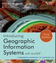
Introducing Geographic Information Systems with ArcGIS


Introducing Geographic Information Systems with ArcGIS


Foreword by Jack Dangermond

Introducing Geographic Information Systems with ArcGIS offers a unique approach to GIS instruction. In it, Michael Kennedy re-creates his time-tested methods of teaching GIS in the classroom in a step-by-step guidebook to GIS. Students on a journey to learn GIS with Professor Kennedy may feel like he is taking the journey with them, offering them his sage advice each step of the way.

Monday, 18 March 2019

QGIS Training Manual Release 3.4


Background
In 2008 we launched the Gentle Introduction to GIS, a completely free, open content resource for people who want to learn about GIS without being overloaded with jargon and new terminology. It was sponsored by the South African government and has been a phenomenal success, with people all over the world writing to us to tell us how they are using the materials to run University Training Courses, teach themselves GIS and so on.

Wednesday, 13 March 2019

QGIS User Guide, Release 2.18


Foreword
QGIS is an Open Source Geographic Information System. The project was born in May of 2002 and was established as a project on Source Forge in June of the same year. We’ve worked hard to make GIS software (which is traditionally expensive proprietary software) a viable prospect for anyone with basic access to a personal computer. QGIS currently runs on most Unix platforms, Windows, and macOS. QGIS is developed using the Qt toolkit (https://www.qt.io) and C++. This means that QGIS feels snappy and has a pleasing, easy-to-use graphical user interface (GUI)

SAGA GIS Manual-Satellite Image Analysis and Terrain Modelling


This training manual has been developed with support from the Australian government via funding provided through their Artisanal and Small-scale Mining for Development project being implemented by Charles Darwin University. This project has been run and the material for this manual developed in collaboration between three universities in Eastern Indonesia and Australia 1) Charles Darwin University (Darwin), 2) UNDANA University (Kupang) and 3) Haluoleo University (Kendari – South East Sulawesi).

Monday, 11 March 2019

Remote Sensing in an ArcMap Environment

Tutorial eBook Remote Sensing in an ArcMap Environment


Introduction to this Manual

This manual, and associated videos, introduce users of ArcGIS to image analysis capabilities, now available in ESRI’s ArcGIS 10.X versions. The user does not need prior knowledge of ArcGIS as we provide a review ArcMap and ArcCatalog basics, although prior knowledge of ArcGIS is helpful.

Monday, 4 March 2019

Semi-Automatic Classification Plugin for Qgis

Version 5.3.6.1


SCP

Developed by Luca Congedo, the Semi-Automatic Classification Plugin (SCP) is a free open source plugin for QGIS that allows for the semi-automatic classification (also known as supervised classification) of remote sensing images. 

SCP


It provides several tools for the download of free images, the preprocessing, the postprocessing, and the raster calculation (please see What can I do with the SCP ? (page 257)). The overall objective of SCP is to provide a set of intertwined tools for raster processing in order to make an automatic workflow and ease the land cover classification, which could be performed also by people whose main field is not remote sensing. 

Wednesday, 27 February 2019

Exercise eBook Learning ArcGIS Pro

Create, Analyze, Maintain, and Share 2D and 3D Maps With Powerful Tools of ArcGIS Pro


Preface Esri’s ArcGIS Platform is the premiere GIS solution for those wishing to build a fully functional and scalable GIS. ArcGIS includes many integrated components, such as desktop applications, databases, image and web servers, cloud applications, and data along with mobile and web applications. ArcGIS Pro is Esri’s latest addition to this already amazing GIS platform. 


Learning ArcGIS Pro

ArcGIS Pro is a 64-bit desktop GIS application that makes use of a modern ribbon interface. This means that it has the ability to make full use of modern computer hardware while at the same time presenting users with an easy-to-use and intuitive interface. It contains powerful tools for visualizing and analyzing 2D and 3D data. This book will take you from software installation to performing geospatial analysis. It is packed with how-to use for a host of commonly performed tasks. You start by learning how to download and install the software, including hardware limitations and recommendations.

Exercise Workbook-Introduction to 3D Data Modeling with ArcGIS 3D Analyst and Google Earth


Introduction to 3D Data 
by K. Heather Kennedy


Preface Introduction to 3D Data teaches GIS specialists, analysts, and technicians how to use ESRI ’ s ArcGIS 3D Analyst to model and analyze three - dimensional geographical surfaces, create 3D data, and produce displays ranging from topographically realistic maps to 3D scenes and spherical earthlike views.

Monday, 25 February 2019

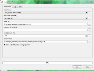
Land Cover Mapping and Classification Accuracy Assessment in QGIS

Classification Accuracy Assessment in QGIS

The main goals of this Module are to become familiar with QGIS, an open source GIS software;
 construct a single-date land cover map by classification of a cloud-free composite generated from Landsat images; and complete an accuracy assessment of the map output. The tools for completing this work will be done using a suite of open-source tools, mostly focusing on QGIS.
The land cover map will be created by training a machine learning algorithm, random forests, to predict land cover across the landscape. The random forests model is trained from a user generated reference data set – collected either in the field or manually through examination of remotely sensed data sources.
Classification Accuracy Assessment

The resulting model is then applied across the landscape. Finally you will assess agreement with a second reference data set generated using a stratified random sampling process and high resolution aerial imagery.

The reference data set will be compared to the classified map image to determine the accuracy estimates. Modules 3 and 4 have been adapted from Exercises and material developed by Dr. Pontus Olofsson, Christopher E. Holden, and Eric L. Bullock at the Boston Education in Earth Observation Data Analysis in the Department of Earth & Environment, Boston University. To learn more about their materials and
their work, visit their github site at https://github.com/beeoda

Introduction
The tools for completing the workflow in this module are all open-source; QGIS is the primary tool used to complete both the land cover map and land cover change map workflow. A QGIS install was created from the OSGeo4W and is included on the website for download.
It includes these additional packages:
 GDAL
 Orfeo ToolBox
 QGIS
 Python

Objectives
 Explore the QGIS Terminal
 Create a false color image from the SWIR, NIR, and Red bands from the cloud free Landsat composite image,
 Stack image bands, and
 Do some basic image band arithmetic.

Download Link

Sunday, 24 February 2019

Training Manual on Remote Sensing and GIS

Application of Remote Sensing and Geographic Information Systems for Mapping and Monitoring of Glaciers Part 2 - Glacier Database Generation using ArcGIS


Training Manual

About the Manual
This manual provides an introduction to Geographic Information Systems (GIS) and ArcGIS software.
The ArcGIS platform and tools are explained so that they can be used for generating glacier database, analysis on glacier database and preparing glacier maps. The manual is divided into three parts – first part includes the introduction of GIS and descriptions of some of the fundamental terms used in GIS. The second part includes the hands-on exercise on ArcGIS to make you familiar on the software and the third part includes the detail exercise for generating different attribute of the glacier polygon with some analysis.
Read the manual carefully before doing hands-on exercises. Step by step processes are explained in bullet point format and short introductions to the data processing steps are in normal format. Practice data for this manual are available at this link: http://www.icimod.org/glacierdata/glacier_training_data.zip

Sunday, 17 February 2019

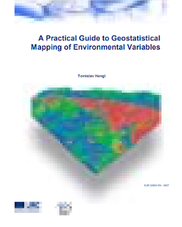
Training Manual-A Practical Guide to Geo-statistical Mapping of Environmental Variables

The guide consists of four chapters. The first chapter is an introductory chapter to the practice of geostatistical mapping and gives an overview of the spatial prediction techniques. The second chapter zooms into regression-kriging and its characteristics, advantages and limitations. 


A Practical Guide to Geostatistical Mapping of Environmental Variables


The third chapter is completely dedicated to installation and doing first steps in the software, and the last, fourth, chapter gives a step-by-step guide through analysis and generation of final layouts by using a digital soil mapping case study. After reading the first chapter, you should understand what the geostatistical mapping is; after reading the second chapter, you should know how to select the right spatial prediction technique for your application; after reading the third chapter, you should be able to install all packages used in the handbook and be aware of their capabilities; and after reading the fourth chapter, you should know how to run geostatistical mapping, prepare final layouts and interpret the results of analysis for your own case study. This guide evolved as a lecturing material that has been used for a 5-day training course called “Hands-on-geostatistics: Merging GIS and Spatial Statistics”. The objective of this course was to provide theoretical backgrounds and practical training on the use of hybrid geostatistical/GIS tools for various applications ranging from spatial prediction to sampling and error propagation. In addition, the leitmotive of the course was to provide practical training in command-based software packages such as R. We aimed at Master and PhD level students and post-doctoral researchers in various fields of environmental and geo-sciences interested in spatial prediction and analysis of environmental variables. We have run this course already twice: at the Facolta di Agraria in Naples (29.01-03.02.2007), and at JRC Ispra (03.06-07.06.2007). At both occasions, the interest exceeded our expectations.

Thursday, 14 February 2019

DIGITAL ELEVATION MODELS-A Guidance Note on how Digital Elevation Models are created and used – includes key definitions, sample Terms of Reference and how best to plan a DEM-mission.


Digital Elevation Model

Executive Summary

The cost of creating DEMs can be significant, often running into millions of dollars, due to their diverse and extensive utility. The use of DEMs is abundant in spatial analyses. As such, a clear understanding of the range of DEM types and applications, their operational requirements, and pros and cons of each model is important before deciding whether to acquire existing data or commissioning a new survey. Having robust background knowledge can help plan the optimal DEM acquisition. 


Sunday, 10 February 2019

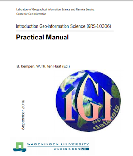
Introduction Geo-Information Science- practical manual

Introduction Geo-Information Science- practical manual .The practical manual contains eleven modules. After this introduction there are ten modules dealing with basic GIS topics using the software package ArcGIS 

Introduction Geo-Information Science-Practical Manual
and one module dealing with Remote Sensing topics using the software package Erdas Imagine. Each module is divided into sections that treat different aspects of one topic. Each section contains some background information followed by software instructions and one or more exercises to practice the theory and to test whether you understood the subject. By the end of this practical you will be able to use GIS and Remote Sensing software as tools to help you work on a practical case study. Although some theoretical background is given in each module, this manual is not meant to be a lecture textbook, so for explanations about GIS-concepts we refer to the lectures (PowerPoint presentations are available on the course website) and the lecture book and reader (see below). The practical must be regarded as an extension of the lectures in which GIS and Remote Sensing theory is clarified by means of exercises using the software packages ArcGIS and Erdas Imagine.  
Download link
http://bit.ly/2IdMrMC

Sunday, 27 January 2019

Training Module: Geoinformatics Applications in Disaster Management


Preface

Geo-information data and tools like Remote Sensing (RS), Geographic Information Systems (GIS) and Global Positioning Systems (GPS) have increasingly been used world over in pre, during and post disaster phases for generating updated maps, integrating information, visualizing scenarios and identifying and planning effective solutions. 


As part of capacity-building and training activities on disaster management, NIDM has been implementing various training programmes at national and state levels for technical working group members, disaster managers and community representatives. Training programmme on Geoinformatics in Disaster Management has been offered by the institute since 2005.


GRASS Reference Manual Raster Commands


GRASS Introduction 

GRASS (Geographic Resources Analysis Support System) is a raster based GIS, vector GIS, image processing system, and graphics production system. GRASS contains over 200 programs and tools to render maps and images on monitor and paper; manipulate raster, vector, and sites data; process multi spectral image data; and create, manage, and store spatial data. GRASS uses both an intuitive windows interface as well as command line syntax for ease of operations. GRASS can interface with commercial printers, plotters, digitizers, and databases to develop new data as well as manage existing data. GRASS is ideal for use in engineering and land planning applications. Like other GIS packages, GRASS can display and manipulate vector data for roads, streams, boundaries, and other features. GRASS can also be used to keep maps updated with its integral digitizing functions. Another feature of GRASS is its ability to use raster, or cell, data.

Contact us

Name

Email *

Message *

Follow us on Facebook and YouTube